 I love to paddle rivers. But I don’t always have a party to paddle with. That’s a problem for three reasons:
- Paddling with others is more fun;
- It’s safer, and;
- From a purely selfish standpoint, paddling with a party makes setting up a shuttle a whole lot easier.
Usually.
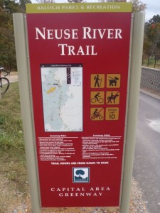
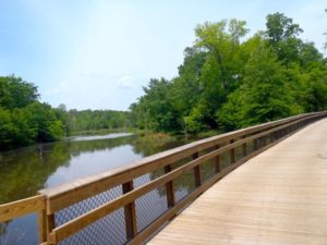
Like most folks, I’m excited about the near completion of Raleigh’s Neuse River Trail, a 27.5-mile greenway following its namesake river from the base of Falls dam south to the Johnston County line. (The missing link, a 3/4-mile stretch below Horseshoe Farm Park is scheduled to open early next year). And, like most folks, I’m excited for the cycling/running/walking potential the greenway offers.
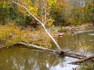
But I’m also excited because the greenway offers a great shuttle option for paddling the Neuse. With the greenway paralleling the river, there’s no more direct shuttle option. If you’re a runner/paddler, you get your daily run in with your paddle trip. If you’re a cyclist, you get a nice ride in as well.
Along the 27.5-mile stretch, the city of Raleigh has five official canoe/kayak access points. That is, accesses designed specifically for putting in and taking out. Accesses with parking and designed for easy access and egress from the river. There are also two unofficial access points that offer adequate, safe parking and manageable access for your canoe or kayak.
The arrangement of seven access points allows for all sorts of trip permutations.
Say you’re neither a runner nor a cyclist, but you do like a good walk. Put in at the Millburnie Dam Access and take out at the Poole Road Access for a 3.5-mile paddle and shuttle walk (which can be knocked out in an hour at a brisk pace). Training for a marathon? The 9.1-mile shuttle run from the Auburn Knightdale Road Access downstream to Covered Bridge Road gets your moderate training run out of the way, then gives you time for a nice, long, mellow paddle. And cyclists can get in an 18-mile ride heading from the Buffaloe Road Access down to Covered Bridge Road. (In planning your greenway shuttle, just remember that missing 3/4-mile link below Horseshoe Farm Park.)
Below are the specifics on each canoe/kayak access and the pertinent info you need to set-up a greenway shuttle. We’ve also included an interactive Google map showing the greenway and access points to further assist in setting a people-powered shuttle. And, of course, you can use this information to plan a monotrip: a bike ride, a run, a hike.
Note: the Neuse is a dammed river that is usually runnable, even in summer. To make sure, though, check the U.S. Geological Survey gauge at the dam here, then consult Paul Ferguson’s “Paddling Eastern North Carolina” to find out whether the gauge bodes well for a trip.
Neuse River Trail paddle access
Click on map for an interactive version
View Neuse River Canoe Access & Shuttles in a larger map
1. Falls Dam Access
Location: 12098 Falls of the Neuse Road. From I-540 take Falls of the Neuse Road Exit 14. Go 3 miles and just before crossing over the Neuse River turn right on a marked paved road that ends at the access point.
River section: 10.5 miles
Bike shuttle: 10.5 miles
Car shuttle: 10.9 miles
Paddle: Long stretch with a few riffles. Rentals and shuttle available through nearby Paddle Creek.
Greenway: Popular stretch backing up to the Bedford at Falls River neighborhood on the north end. Ends near Buffaloe Road Athletic Park. Note: a 3/4-mile stretch of this stretch between the WRAL Soccer Complex and Horseshoe Farm Park is under construction with an expected completion of early 2014.

2. Buffaloe Road Access
Location: 4901 Elizabeth Drive. From I-440/Beltline take U.S. 64 East Exit 11B. Go 2 miles and turn right on Buffaloe Road. Travel 3.6 miles and just before crossing the river turn right on Elizabeth Drive, which ends at the access point.
River section: 3.5 miles
Bike shuttle: 3.5 miles
Car shuttle: 5.8 miles
Paddle: Includes a long backwater stretch from the Milburnie Dam. Oh, yeah, the dam: a 10-foot dam is 3.5 miles downstream. Portage on either side is iffy; the city does not maintain portage walkways. A good candidate for an out-and-back trip.
Greenway: The backwater stretches make for some mellow passages past standing water.
3. Milburnie Dam Access
Location: 1101 Old Milburnie Road. From I-440/Beltline take U.S. 64 East Exit 13B. Go 2.7 miles and just after crossing the bridge over the river turn left on Old Milburnie Road. Travel 0.2 miles and turn left on Loch Raven Parkway. Travel 100 yards and turn right onto a gravel road which leads to the river access downstream of the dam.
River section: 2.0 miles
Bike shuttle: 2.0 miles
Car shuttle: 2.5 miles
Paddle: Class I rapid shortly into the trip and a Class II at certain water levels just above the takeout at Anderson Point.
Greenway: Includes stretch of original Neuse River Trail, which opened in the mid 1990s. Access, on east side of river, is linked by footbridge to west side of river.
4. Anderson Point Access
Location: 20 Anderson Point Drive. From I-440/Beltline take U.S. 64 East Exit 13B. Go 2.1 miles on New Bern Ave. Turn right on N. Rogers Lane. Continue until you reach a stop sign; go right to stay on N. Rogers Lane. Turn Left on Robbins Drive. Take the first right on Anderson Point Drive. Turn left into a small parking lot before crossing the bridge over HWY 64 into Anderson Point Park. At the end of the parking lot is a gravel road leading to the river access.
River section: 1.5 miles
Bike shuttle: 1.5 miles
Car shuttle: 3.0 miles
Paddle: Short run.
Greenway: Pay attention to signs in Anderson Point Park; passage can be tricky. Will pass over Crabtree Creek and future connection with Crabtree Creek Greenway.
 5. Poole Road Access
Location: 6501 Poole Road. From I-440/Beltline take the Poole Road East Exit 15. Travel 2.4 miles and turn left on the gravel road best before crossing over the river.
River section: 3.1 miles
Bike shuttle: 3.1 miles
Car shuttle: 5.1 miles
Paddle: A riffle or two, overall easy passage.
Greenway: Short stretch with a bit more up and down than the rest of the trail
6. Auburn Knightdale Road Access
Location: Unofficial access where Auburn Knightdale Road crosses the Neuse. From U.S. 70 just east of I-40 go left on Auburn Knightdale Road. Go 3.2 miles; access parking is on the right, before crossing the river.
River section: 10.0 miles (approximately)
Bike shuttle: 9.1 miles
Car shuttle: 16.8 miles
Paddle: Long stretch that departs development and meanders through farm and pastureland.
Greenway: Includes the lone stretch of the 27.5-mile Neuse River Trail that departs from the river’s banks, taking an upland route through pasture.
7. Covered Bridge Road
Location: Unofficial access where Covered Bridge Road crosses the Neuse. From U.S. 70 in Clayton go north on Shotwell Road. After less than a mile, go right on Covered Bridge Road. River access is just past the river, on the right.
* * *
Like us on Facebook and get health, fitness and outdoors news throughout the day.

How do you access the greenway on Louisburg road, without crossing 401? That is, riding from the dam to CASL, then out to Perry Creek (on sidewalk), can you bike to the west side of Louisburg Road, and then continue on the greenway to Johnston County line?
Your best bet is to cross 401 on Perry Creek Road, then pick up the greenway from the access off Trailhead Lane.