For the most part, you can hike in the mountains year-round. Hiking in the Piedmont is enjoyable from October into May, and at the coast conditions are favorable for three, maybe four months of the year (the non bug-infested months). Winter, though, is the one time when all regions, from mountains to sea, are in play for a good hike. Here are our recommendations for hikes that seem especially well-suited for December.
Coast
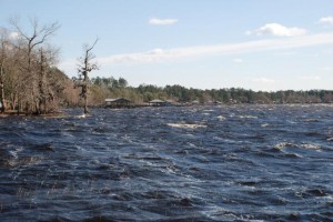
Lake Waccamaw State Park, Lake Waccamaw. Lakeshore Trail, 5 miles. More info here.
This coastal plain trail takes in a little of everything on its journey from the Visitors Center along the shore of this Carolina Bay to the Waccamaw River. According to the park website, the trail “cuts through a pine forest, past one of the oldest stands of cypress trees in the area, under towering hickory trees, alongside grass beds in the lake that provide cover for a variety of fish species and beside sandy beaches perfect for picnicking or pausing to gaze across the lake.” Expect a variety of color. Learn more about the park — including where the heck it is and how to get there — at its website. Enhance your visit by going on Saturday, Dec. 21, and signing on for the Holiday Hike, a ranger-led hike focusing on winter tree ID.
Piedmont
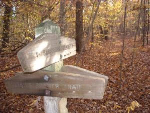
Uwharrie National Recreation Trail, Uwharrie National Forest, 40 miles, with shorter options (Trip No. 36, “Backpacking North Carolina,” Hike No. 37, “100 Classic Hikes in North Carolina”). Details on the forest here. Back in the 1970s, when the Uwharrie Trail was originally blazed, it covered 50 miles and was a popular backpack destination for regional scout troops. Fittingly, it was those very troops who helped build the trail. Parts of the trail later fell into disrepair; the useable part of the trail dropped by half. But the Uwharrie Trail is on the rebound: Early this month a new 4-mile run opened linking the 20-mile Uwharrie National Recreation Trail to the south with a trail network in the Birkhead Mountain Wilderness Area, creating 40 miles of continuous trail. The growing trail provides access through the Uwharrie National Forest, site of an ancient mountain chain where peaks once climbed to 20,000 feet but today fall short of 1,000. Quick climbs through this Southern Appalachian hardwood forest are greeted not with peaks but rounded ridgelines featuring chunks of exposed granite. Lower passages are often along several creeks that penetrate this mid-state national forest. Three roads cross the trail, making for shorter, shuttled options.
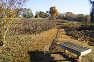
Greensboro watershed lakes, 42 miles total, short hikes of as little as a mile. Details here. Falls is a great time for hiking. Alas, it’s also a great time for several other activities, starting with watching college and pro football. Much as you’d like to hit the road for a day trip in the mountains, kickoff is at 1. What’s a sports fan to do? Hike closer to home. Triad residents have numerous good options around the three watershed lakes — Brandt, Townsend and Higgins — north of town. Forty-two miles of watershed hiking trails take you through a variety of environments. The 1.6-mile Palmetto Trail, for instance, features some interesting geology; the 3.6-mile Nat Greene Trail offers a smorgasbord of Piedmont ecology.
Mountains
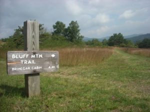
Doughton Park: Basin Cove Loop, Blue Ridge Parkway near Boone, 7-18 miles (Trip No. 11 “Backpacking North Carolina”). This trip has all sorts of options. Starting from Longbottom Road at Basin Creek you immediately have three: To the north, Cedar Ridge Trail takes you up to the Parkway near the Brinegar Cabin, where you can catch the Bluff Mountain Trail south through the vast meadows and balds that make Doughton Park a popular Blue Ridge Parkway destination. To the south, Flat Rock Ridge Trail traces another ridgeline up to the Parkway, where you’ll take Bluff Mountain Trail north through Doughton Park. Straight takes you up Grassy Gap Trail to a primitive campground where three options await. The 2-plus-mile Bluff Mountain Primitive Trail takes you straight up the escarpment to Doughton while the southern veering Grassy Gap Trail, following old roadbed, is the most mellow way to reach the top. Or, take the Basin Creek Trail up a narrow canyon where falls seem to trip over themselves for your attention. The trail ends at the one-room Caudill cabin, where a determined couple raised 13 kids more than a century ago. Not a bad option in the bunch.
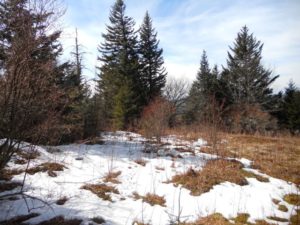
Sam Knob Loop (Trip No. 14, “Backpacking North Carolina”). This loop off the Blue Ridge Parkway on the edge of the Shining Rock Wilderness is the ideal spring opener. It’s not too long (8.2 miles), water is assured but, at this altitude (between 5,000 and 6,000 feet) not an obstacle, and there’s just enough climbing to wake your hibernating legs, but not enough to make them wake grumpy. Plus, mile-for-mile it may be the most scenic trip in the book, taking in just about every type of southern Appalachian landscape — from balsam forest to rocky knob to open meadow and tight rhododendron passage — imaginable. A good overnight trek.
Joe,
Happy New Year! I have read your book (Backpacking in NC) and I enjoy your blog.
Thank you for posting your information about hiking in the Uwharries. I live in the Cary / Apex area and I frequently drive through the Uwharrie National Forest when I use 64 / 49 to visit my parents in Charlotte.
I have been meaning to day hike in the Uwharries sometime this winter. I have a 1998 copy of the “Uwharrie Lakes Region Trail Guide” by Don Childrey. The route I would like to try first is the Birkhead Mountain Trail, starting at the Tabott’s Branch Trailhead. Childrey’s book says there is no parking available at this trail head…that you have to park alongside the road. Do you know if this is still the case?
Thank you.
Steve
Hi Steve,
Talbott’s Branch may be another name for the Tot Hill Road trailhead. In 1998 there was no parking at that trailhead and it was hard to find; today, there’s a nice gravel lot with a kiosk. And the 2 miles of the Birkhead Mountain Trail that leads in from that trailhead takes in the best of the Birkheads. Using that trailhead, it’s about an 11.5-mile loop.
Hope that helps,
Joe