When it comes to winter hiking, we tend to develop a circle-the-wagons mentality: Who knows what might happen with the weather. Better keep my winter hiking close to home.
It’s a valid thought. But it needs tweaking.
True, if you live in the Piedmont, the weather is a bit more predictable than in the mountains. We learn this in summer when there’s no rain in the forecast, and then — boom — darned if a thunderstorm doesn’t roll through mid-afternoon. A drenching rain in the heat is one thing. A cold rain-turned-sleet-and-snow in winter is a much more formidable, and potentially life-threatening, matter. So why take the risk?
We offer two ways around this line of thinking. We also offer up three hikes that fall into each category.
Go east, young man
Or young woman, or not-so-young man or … well, just go east. The coast offers some great hiking that’s a lot more accessible in the cold, when the snakes are hunkered down, the insects at bay. In fact, a lot of hikes at the coast you wouldn’t think of doing between mid-March and mid-October, when the temperature rises above 65. Here are three favorites, and why:
- Pettigrew State Park, Columbia, N.C. A major component of the park is 16,000-acre Lake Phelps, the second largest lake in the state and estimated to be about 38,000 years old. Though there’s been agriculture nearby and humans have been here for at least 10,000 years (one of 30 well-preserved dugout canoes from the lake is about 4,400 years old), a rim of forest around the lake’s east edge has been virtually untouched and houses an ancient stand that includes bay trees, sweet gums, persimmons, and pawpaws that are among the largest of their species found anywhere. You’ll also find a stand of rare Atlantic white cedars with trunks three feet in diameter and canopies topping 100 feet. About 5 miles of trail lets you explore a great deal of what the park has to offer.
- Merchants Millpond State Park, Gatesville, N.C. Most people who’ve even heard of this park tucked in the northeast corner of the state think of it as “that place on a swamp where you can rent canoes.” That “swamp” is actually a 760-acre millpond-gone-wild that now is home to healthy stands of bald cypress and tupelo gum trees. And while it is the park’s main attraction, Merchants Millpond also has 9 miles of trail that explore the park’s surprisingly dry — thanks to boardwalks and trails sticking to ridges (such as they are) — wetlands. The 6-mile Lassiter Trail takes you deep into the woods, the 2-mile Bennets Creek Trail gives a nice sampling of flora and fauna. Hike the latter and you may even have time to rent a canoe and paddle the pond.
- Great Dismal Swamp National Wildlife Refuge, Suffolk, Va. One of the joys of winter hiking at the coast is the feeling of being utterly alone. That’s especially true of the Great Dismal, which at one point covered about 1 million acres and was known as a place where people went and get lost, sometimes intentionally. Today, the Great Dismal Swamp National Wildlife Refuge is about a tenth that size and is far harder to get lost in. A series of gravel roads parallel the drainage ditches built years ago to try and drain the swamp for agricultural purposes. Today, those gravel roads offer the only access into the swamp, from four access points surrounding the preserve. You can walk here for hours in the winter, the maintained gravel roads requiring little of your attention. Your mind is free to wander, or to focus on the diverse fauna, which includes 96 bird species known to nest here (more than twice that number have been spotted in the preserve).
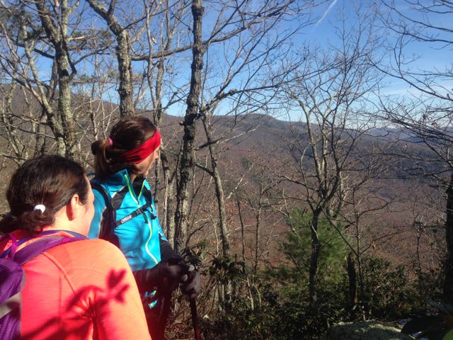
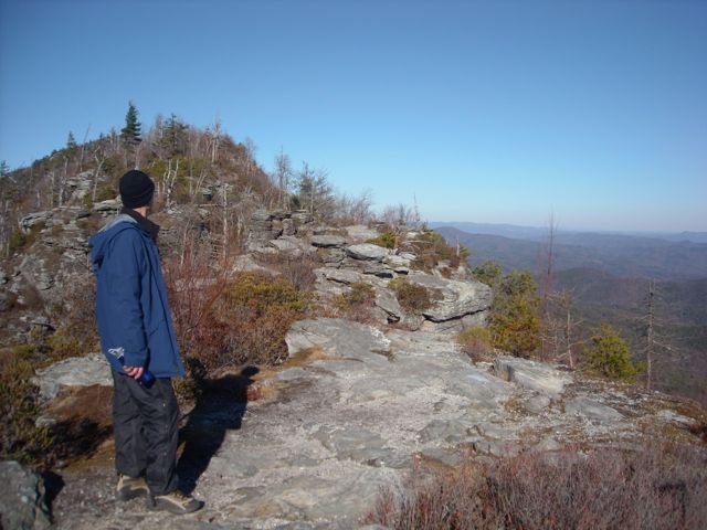
Go west (but not too far)
So yes, mountain weather can be tricky in winter. Wet and cold can be a dangerous combination if you don’t have the right clothing, and even getting to the trailhead is a challenge on icy roads. Still, you do love that winter mountain experience — and you can have it by avoiding going too far into the mountains.
Here are three favorite trails that provide a mountain experience minus the threat posed by high elevation.
- Doughton Park: Long Bottom Road Access, Blue Ridge Parkway near Roaring Gap, N.C.. When most people think of hiking at Doughton Park, they think of picking up the Bluff Mountain Trail as it parallels the Parkway for about 7 miles. Trouble is, the Parkway can close in a moment’s notice should the road ice up. That’s not a concern when you access the Parkway from the Long Bottom Road Access at the base of the Blue Ridge Escarpment. From here, take the 4.4-mile Cedar Ridge Trail to the top, gaining about 2,000 feet of vertical elevation along the way. You’ll T into the Bluff Mountain Trail: go right for about 100 yards and check out the Brinegar Cabin, go left and hike through the mountain meadows that Doughton is known for. Other options include the 5-mile Flat Rock Ridge Trail, which also takes you to the top, and the Grassy Gap Road trail which travels 6.5 miles to the Bluff Mountain Trail and also connects with the 3.3-mile Basin Creek Trail and the 2.8-mile Bluff Ridge Primitive Trail. Stellar hiking all.
- Schoolhouse Ridge/Thorps Creek Loop, Wilson Creek, Mortimer, N.C. 5.6 miles. We tend to shy away from the Wilson Creek area because so many of its trails are intertwined with water, and wet winter crossings ain’t a lot of fun. This hike crosses Thorps Creek several times, but only the first crossing (the lowest) might be wet. From the Mortimer campground, pick up the Thorps Creek Trail for a gradual climb that gains 1,234 vertical feet in about 2.5 miles. After reaching FS 4068, go left for a half mile and return on Schoolhouse Ridge Trail, back to the campground (albeit the opposite end you started from). There’s a nice waterfall at the start, a good view or two at the top. Afterward, check out the daily special in Mortimer at Betsy’s Country Store. Elevations topping out below 2,400 feet help Wilson Creek avoid the winter extremes found just a few miles away at Grandfather Mountain.
- Linville Gorge: East Rim, Linville Falls, N.C.. 14.1 miles, with shorter options. Out-of-town visitors are always looking to do “name” adventures — something the folks back home probably have heard of and would likely be impressed by. Linville Gorge is one of those places in North Carolina, an area known for its rugged beauty, waterfalls and 1,300-foot deep (in spots) canyon. A great way to explore this wilderness is from along its East Rim. More adventurous types can start at the south end of the gorge, from the Wolf Pit Road access, and within two steep miles be atop Shortoff Mountain (from there, the hiking levels considerably for about three miles as you head north). Or, take Forest Service roads up to the Table Mountain access where you can quickly climb 3,680-foot Tablerock Mountain (great 360 views), check out The Chimneys (popular with climbers) or take the Spence Ridge Trail, down into the gorge (it’s the easiest trail down, though in Linville Gorge, “easiest” is a relative concept).
More info
For more information on these hikes click the appropriate links. And if you have copies of “Backpacking North Carolina’ and/or “100 Classic Hikes in North Carolina,” you can find details and maps on several of these hikes therein.
- Pettigrew State Park
- Merchants Millpond State Park
- Great Dismal Swamp National Wildlife Refuge
- Doughton Park: Long Bottom Road Access,
- Schoolhouse Ridge/Thorps Creek Loop, Wilson Creek
- Linville Gorge: East Rim
Winter Wild hike series
Another option for winter exploring: our GetHiking! Winter Wild hike series. Monthly off-trail hikes from November through March to the places you thought you knew. Space is limited; more info and sign up here.