My hikes can be more vicarious than real. It’s a nice two-for-one benefit of hanging with adventurous folks who like to get around.
Sunday, for instance, I caught up with Howard for the first time since he’d returned from hiking a section of the Camino de Santiago in June. I was especially interested because Howard’s plan was to average 15 miles a day for 7 days; Howard is in good shape and a strong hiker, but that’s the kind of mileage AT thru-hikers aspire to — after building up for a month on the trail.read more
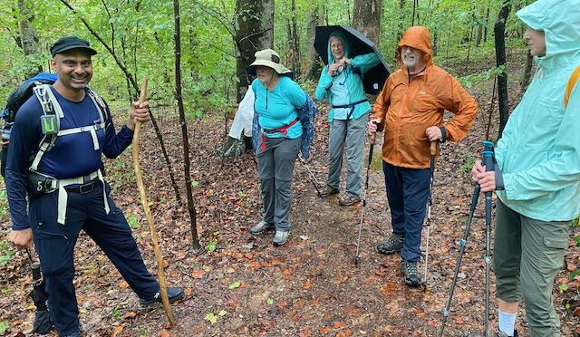
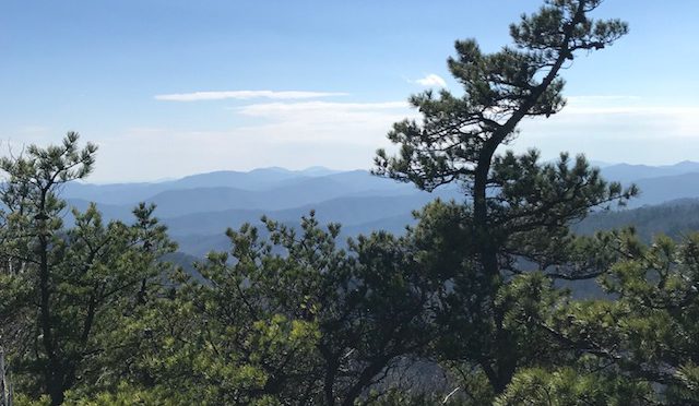
It’s been cool most of the week throughout our blogging area, and it will be cool again at least on Saturday, making this the perfect summer weekend to get in a hike.
Mount Jefferson Downhill Skateboarding Event, Saturday and Sunday, starts at 9 a.m. both days, Mount Jefferson State Natural Area, West Jefferson. Scratching your head, are you? Here’s the deal: The 1.6-mile road to the summit of 4,683-foot Mount Jefferson will be closed to vehicles both days to accommodate the mountain’s annual downhill skateboard race. Yup, youngsters on skateboards — more than 100 of ‘em — will skateboard down the mountain, dropping more than 700 vertical feet along the way. However, there will be shuttle service to the top of the mountain: park at the Lowe’s in West Jefferson and take a shuttle to the top, where you can hike the park’s 5 miles of trail. And you can check out the race as well. (FYI, one of the sponsors for the race, the Ian Tilmann Foundation, will be giving helmets to the first 100 kids who sign a pledge to wear a helmet while skateboarding.) Learn more about the race here and hiking at Mount Jefferson here.read more
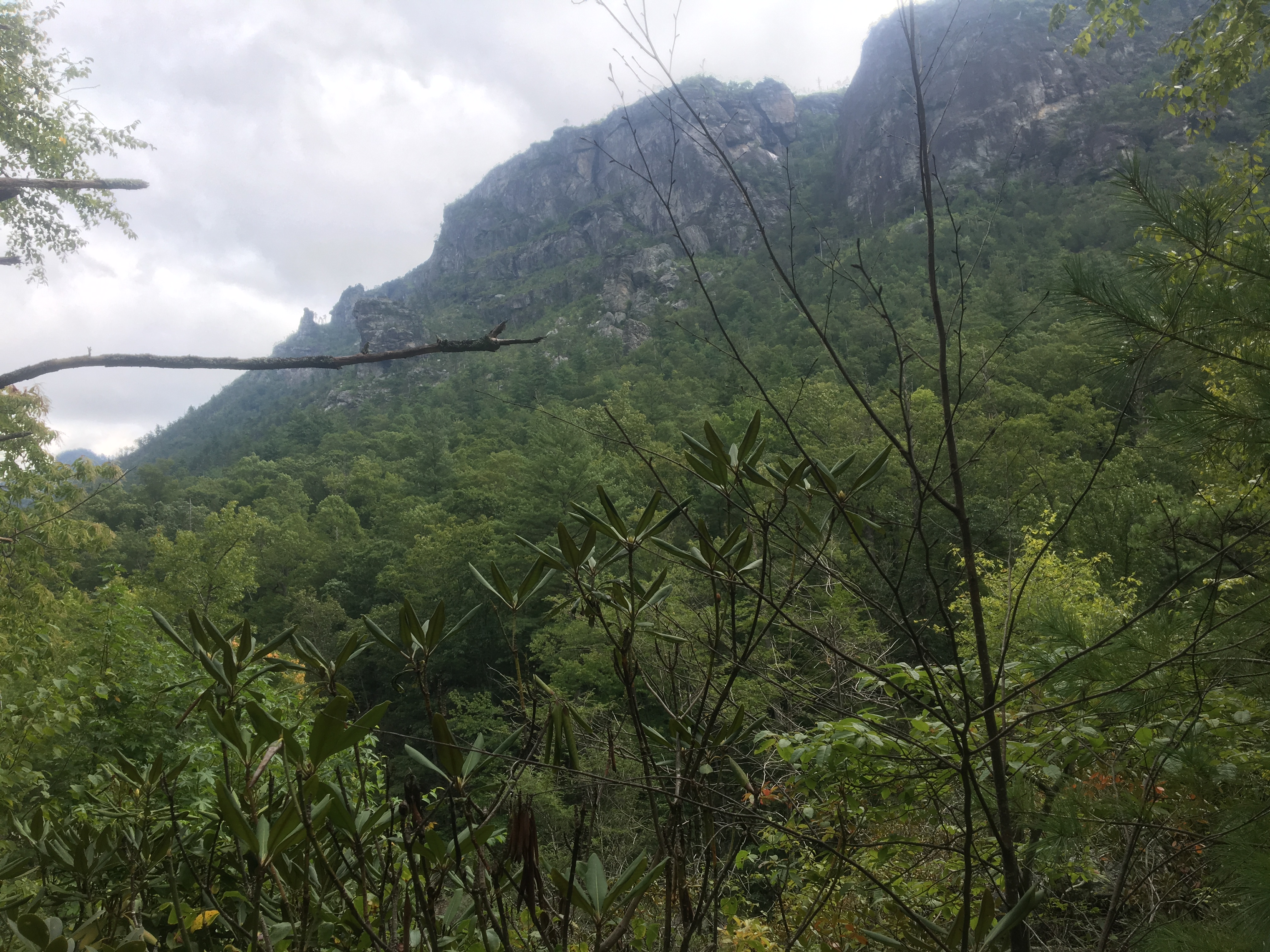
Looking up from the Linville River to The Chimneys.
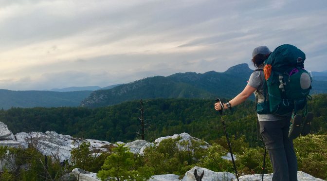
We love the idea of exploring the wild places out there. But actually doing it can be daunting.
The wildest place we know of in the Southeast is Linville Gorge. Most of the 11,651 acres is wilderness. The gorge is just three-quarters of a mile across, from rim to rim, and is as deep as 1,500 feet in spots. On its 13-mile run through the gorge, the Linville River drops 2,000 vertical feet. So inaccessible is much of the gorge that it contains virgin timber, a rarity in this part of the world. Trail descriptions are peppered with such phrases as “very strenuous,” “very primitive,” and “notoriously steep.” There is no “easy” in Linville Gorge.
That makes its spectacular scenery all the more desirable.
One of my most memorable views of the past couple years was from a spot along the Linville River not far from Pinch-In Trail. I glanced across the river and up, up about 1,900 vertical feet to The Chimneys, a prominent rock outcrop that loomed like the prow of an ocean liner over a row boat. To earn this view, I had descended, in full pack, the ridiculously steep, roughly defined Leadmine Trail, then hiked up the boulder-choked Linville Gorge Trail. It was laughingly slow going. But then this view.
Explore, don’t expire
Not every backpacker, I realized as the eight in my group wrestled with the trail, is ready for this level of adventure—at least in full pack.
So we came up with a trip, scheduled the weekend of Oct. 5-7, that includes the best of backpacking—spending the night in the wild—and the best of day-hiking—exploring with a light daypack that keeps you nimble enough to climb over downed hemlocks and hills of house-size boulders. The trip works like this:
Friday afternoon, we’ll hike in from the Wolf Pit Road access at the southeast end of the gorge. It’s a steady climb, but at just 1.7 miles, it’s doable even for a backpacking novice. We establish basecamp on Shortoff Mountain, in the vicinity of “Camp Shortoff,” where a run of rock outcrops affords some of the best views of the gorge and some of the best sunsets imaginable.
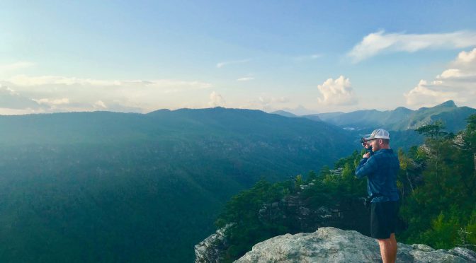
Saturday, we don our day packs and hike about 3 miles north on the Mountains-to-Sea Trail, the flattest 3 miles of trail in Linville, brushing the rim, with more great views of the gorge.
At the 3-mile mark we descend on the Cambric Ridge Trail, which drops, quickly, a little more than a mile down to the river. You won’t see this trail on most maps; it’s one of the primitive trails that are all but hidden in the gorge. We’ll take it down to the river; if the water level is low, we may cross and head downstream and loop back up to basecamp. If the river is up, we’ll hang out, have lunch, maybe take a dip, before heading back to camp. We’ll be in the heart of the gorge, in an area that’s infrequently visited.
Like taking a test drive
Saturday’s hike, about 9-10 miles in all, is a good way for a person to get a feel for experiencing challenging terrain before tackling it in full pack. Even for someone who’s day-hiked rugged areas, doing it as part of backpacking expedition helps put such terrain in a backpacking perspective and thus prepare better for venturing out in full pack. Downed hemlocks—and there are a goodly number of them—are fairly easy to scramble over in a day pack, but what about in a 60-liter pack carrying 30 pounds? Perhaps pare down the load. How about those steep descents? Maybe you don’t use trekking poles on day hikes, but think about all that weight and its impact on your knees dropping down a trail with a 45-degree descent.
We backpack so we can spend as much time as possible on the trail, not because we’re into being punished. A basecamp approach is the ideal marriage of backcountry camping and hiking, especially well-suited to our wildest places.
“You’re hiking where? I’ve never heard of that trail.”
It’s one of our favorite things to hear, because it means we’re meeting one of our key goals: leading you into the unknown. Sure, we hike a lot of trails more than once, and for good reason: they’re worth it. Our Charlotte group goes to South Mountains State Park regularly, our Charlottesville crew loves the Jones Run/Doyles River Circuit in the Shenandoah National Park. And with 120 miles of the Mountains-to-Sea Trail running through the Triangle, I’ve lead a goodly number of hikes on the statewide path along the Eno River and the south shore of Falls Lake.
But it’s the new discoveries most hikers really love.
“Show of hands,” I said at the beginning of a recent hike at the Shallow Ford Natural Area north of Burlington: “How many of you have hiked here before?”
None of the eight hikers raised a hand.
Ditto a recent after-work hike at the two-year-old Brumley Nature Preserve in Chapel Hill, at Little River Regional Park on the Durham/Orange county line, and on the Great Blue Heron Loop Trail at Haw River State Park’s Iron Ore Belt Access area. Some of these gems are new, some simply off the beaten path. We’re constantly on the lookout for both.
This week, we thought we would highlight a few upcoming adventures to places that may be new to you.
Confluence Natural Area, day hike, Hillsborough, July 22. The Eno River Association is one of those land trusts whose work frequently flies under the radar. If you’ve hiked in Eno River State Park, or at Little River Regional Park, you’ve likely hiked on land preserved by the ERA. They typically buy land in the Eno watershed, then, eventually, turn it over to North Carolina State Parks. This spring, though, the ERA opened the 200-acre Confluence Natural Area, its first preserve open to the public, where we’ll explore 2-miles of newly blazed trail.
Standing Indian Recreation Area, hiking/camping weekend, Nantahala National Forest, Aug. 24-26. Standing Indian was new to me when I scouted it in 2009. I was finalizing which trips to include in my book “Backpacking North Carolina” and noticed this big network of trails west of Franklin. It seemed worth a chance — and it was. On this trip, the main hike is an 11-mile loop consisting of a mellow climb up Kimsey Creek to the Appalachian Trail at Deep Gap, then hiking north to 5,498-foot Standing Indian and back to camp on the Lower Ridge Trail. We’ll do a shorter hike Sunday.
Curtis Creek, hiking/camping weekend, Pisgah National Forest, Sept. 28-30. The Curtis Creek area of the Pisgah outside Old Fort is hardly new: in fact, it’s the oldest tract in the Pisgah National Forest, dating back more than a century. It’s also not new in that it’s home to some of the oldest old growth in the Pisgah. We’ll explore here and in the nearby Montreat Wilderness area with a climb up 5,592-foot Graybeard Mountain.
Joyce Kilmer-Slickrock/Citico Creek Wilderness, four-day backpack trip, Nantahala and Cherokee National Forests, Oct. 25-29. This is the mountain land that time forgot. Too rugged and remote to draw much interest from logging concerns, the area was a natural for inclusion as a designated Wilderness Area. The area may be popular with locals — what locals there are — but it’s largely untouched by us outsiders.
Nags Head Woods Preserve, hiking/camping weekend, Outer Banks, Nov. 2-4. Usually, when you head to the Outer Banks, your thoughts are on the beach, not the trail. Yet there’s some stunning hiking to be done, none more so than through the maritime forest at The Nature Conservancy’s thousand-acre Nags Head Woods Preserve. Five miles of trail explores everything from dense woods to the sound. That’s Saturday; on Sunday, we’ll do another five miles amid some of the oldest trees in North Carolina, in Pettigrew State Park.
Interested in expanding your adventure horizons? Find more information on each adventure in the links below and join us.
Happy trails,
Joe
Explore!
Learn more about the new places we’ll be exploring by clicking on the links below.