Today we revisit a topic we first wrote in 2012: 10 of our favorite winter hikes. Hikes that, for various reasons, are especially good hiked in cold weather. For some (at the coast, for instance, it’s the only time you can hike them, lest you have an immunity to squadrons of dive-bombing mosquitoes and an unusually high tolerance for things that slither. For others, it may be a view otherwise obscured by a lush, full forest, or for the opportunity to hike in evergreen conditions, or because of exposed terrain that lets winter’s warming sun shine in.
We include hikes in the coast/coastal plain, in the Piedmont, and even in the mountains, or at least the mountainous regions that remain fairly accessible in winter.
Like any lists of favorites, it has evolved. An early favorite gets replaced not necessarily because it’s any less appealing, but likely because we’ve since hiked a new trail that we’re excited to share. They’re all good hikes, well worth a visit over the next three months.
Coast/coastal plain
1. Jones Lake State Park, 4 miles, Elizabethtown (southeast of Fayetteville). According to “100 Classic Hikes in North Carolina,” (Hike No. 42, or go here for more information) the trail has a total elevation gain of 3 feet (it all happens within a 10-foot stretch on the lake’s north side, where the trail encounters an old irrigation ditch). Part of the trail — through the longleaf pine forest (some interloper pines and understory turkey oaks as well) — is on a sandy forest service road that’s bright and warm on a sunny day. Part — a narrower, packed gravel trail — goes through a dense bay forest rich with sweet, loblolly and red bays. And there’s a cypress swamp as well, all rimming 224-acre Jones Lake, a curiosity in itself, being one of a half million elliptically shaped lakes peppering the southeastern U.S., a phenomenon of unknown origins called a Carolina bay.
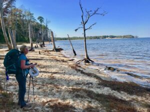
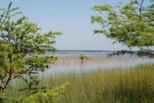
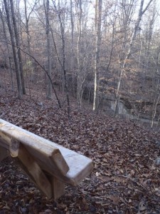
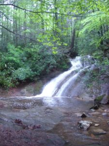
2. Neusiok Trail, Croatan National Forest, Havelock. 20.1 miles, with shorter options. (Trip No. 42, “Backpacking North Carolina,” Hike No. 5, “100 Classic Hikes in North Carolina, or go here.”) The Neusiok, much of which runs through a swamp, has a limited hiking window; if you don’t hit from late November into mid-March, you’ll be sorry (and also plagued by every flying, stinging pest the state has to offer). Wintertime temperatures in the 50s and overnight lows near freezing make this the perfect coastal escape, regardless of whether you like going long (the whole 20.1 miles) or simply chewing off a section or two. An especially rewarding hike on a cool, sunny winter’s day. Note: the Pine Cliff Recreation Area at the northern terminus remains closed due to hurricane damage in 2018. You can access the trail from the nearby equestrian trailhead.
Piedmont
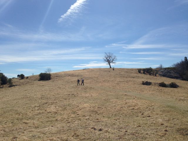
3. Uwharrie National Forest, Birkhead Wilderness, Asheboro, 7.4 miles. (Hike No. 36, “100 Classic Hikes in North Carolina,” Trip No. 35, “Backpacking North Carolina,” or go here.) There’s a starkness to the Birkhead Wilderness, a 5,160-acre notch on the northern tip of the Uwharrie National Forest southeast of Asheboro, that makes it ideal for winter hiking. Although not a particularly mature forest, there’s a dearth of understory that makes for good, long sightlines in this portion of the ancient Uwharrie mountain range that’s a bit mellower elevationwise than to the south. A good, long hike for people who may not think they’re up for a good, long hike. Note: You can also start from the Tot Hill Road Access on the north end of the wilderness; the 2-mile hike to the loop (and 2-mile hike out) makes for an 11.4-mile hike).
4. Johnston Mill Nature Preserve, Orange County. 2.9 miles. (Hike No. 20, “100 Classic Hikes in North Carolina or go here). Normally, you’d expect to spend a good hour in the car to find a spot as remote as the Johnston Mill Nature Preserve. But thanks to the 1999 efforts of the Triangle Land Conservancy, this 295-acre preserve remains intact amid the encroaching sprawl of Durham and Chapel Hill. Your escape from the city happens quickly: From the main trailhead off Mount Sinai Road, you descend through dogwood, red cedar, sweetgums and loblollies into a floodplain forest rich with the rare: four-toed salamanders, Thorey’s grayback dragonfly, green violet, bloodroot, stemmed yellow violet and columbine. Walk along New Hope Creek to the Beech Loop, a bluff trail that gets its name from the sizable Fagus grandifolia that dominate the hillside. Later, check out remains of the Johnston Mill and homestead dating to the early 18th century. An especially foot-friendly tread (trail surface) makes this a particularly good venue for less able hikers.
5. Pilot Creek Trail, Pilot Mountain State Park, Pilot Mountain State Park, Pinnacle, 6.6 miles (out and back). Learn more and plan a hike here. When this list first appeared we recommended the trails accessed at the summit of Pilot Mountain. But since 2012, those trails have been discovered: on nice weekends it can take a half hour or more just to score a parking spot up top. Now, our favorite Pilot Mountain trail is Pilot Creek, which starts from an access off Boyd Nelson Road north of the park and works its way along the north flank of the mountain to connect with the Grindstone Trail. Pilot Creek offers much of what hikers flock to Pilot Mountain for: rocky terrain and some moderately challenging climbs. You won’t get the views (it sticks to the base of the mountain), but you won’t get the crowds, either.
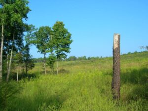 6. Latta Plantation, Charlotte, 4.2 miles. (Hike No. 28, “100 Classic Hikes in North Carolina,” or go here to learn more.) So much hiking, so close to town. Sixteen miles of trail explore this 1,343-acre preserve on the north side of town; we recommend a loop that includes the Hill, Cove and Split Rock trails, a loop that features a rare Piedmont prairie, a type of grassland common in the region prior to the European invasion but rarely found today. This being winter, you’ll miss out on the wildflowers common to a Piedmont prairie (such as the smooth coneflower), but you will get a sense of the vast open spaces that today we typically associate with the West. Some good shoreline and cove hiking on this loop as well.
Mountains
7. Mount Sterling, Great Smoky Mountains National Park. 18.1 miles. (Trip No. 17, “Backpacking North Carolina,” or learn more and plan a hike here). Of course, part of the thrill of winter hiking is the chance to experience some winter. You’ll have a good shot of that on this loop in the Great Smokies, which starts below 3,000 feet and tops out in a balsam forest atop 5,823-foot Mount Sterling. The summit happens early on, after a little more than six miles of hiking (the last 2.2 miles of which gains 1,700 vertical feet). After that it’s a mostly downhill ramble down Mount Sterling Ridge Trail and Pretty Hollow Creek, with a return through Little Cataloochee. Lots of natural beauty interspersed with signs of the park’s cultural past. A most worthy 18-mile day (though there are shorter options).
8. Doughton Park: Basin Cove Loop, Blue Ridge Parkway near Blowing Rock, up to 20+ miles. (Trip No. 11, “Backpacking North Carolina,” Hike No. 54, “100 Classic Hikes in North Carolina,” or learn more and plan a hike here.). Another backpack/day hike option, where you should, at least through mid-month, find some color on a trip that starts at the base of the Blue Ridge escarpment. Hike in the easy 1.5 miles to the campground (establish base camp, if you’re backpacking), then behold numerous options, including: 3.4 miles up Basin Creek to the old Caudill Cabin (16 people living in one room) or head up the 2.8-mile Bluff Ridge Primitive Trail to Bluff Mountain, the Mountains-to-Sea Trail and additional exploring along the Blue Ridge Parkway. Especially nice, again, with the seasonal BRP crowds diminished.
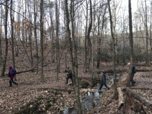
9. Schoolhouse Ridge Loop, Wilson Creek, Mortimer. 5.6 miles. (Trip No. 10, “Backpacking North Carolina,” Hike No. 68, “100 Classic Hikes in North Carolina,” or go here.) January can be a dicey time of year for backcountry exploring in the mountains. The higher you get, the greater the chance for snow and ice — more a problem for driving than hiking. Good reason to say low (between 1,500 and 2,400 feet), yet still reap the benefits of a mountainlike trip. Good reason to visit the Wilson Creek area. One thing about Wilson Creek is the number of creeks that penetrate this rugged section of the Blue Ridge escarpment below Grandfather Mountain, creeks that often present challenging crossings. Not so much the case on the Schoolhouse Ridge Loop. Though it does have multiple crossings of Thorps Creek early on, none are challenging. After that, it’s carefree mountain hiking.
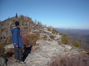
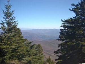
10. Linville Gorge: East Rim, Nebo. 14.1 miles, with shorter options (Trip No. 7, “Backpacking North Carolina,” or go here.). Out-of-town visitors are always looking to do “name” adventures — something the folks back home probably have heard of and would likely be impressed by. Linville Gorge is one of those places in North Carolina, an area known for its rugged beauty, falls and 2,000-foot deep (in spots) canyon. A great way to explore this wilderness is from along its East Rim. More adventurous types can start at the south end of the gorge and within two steep miles be atop Shortoff Mountain (from there, the hiking levels considerably as you head north). Or, take Forest Service roads up to the Table Mountain access where you can quickly climb 3,680-foot Tablerock Mountains (great 360 views), check out The Chimneys (popular with climbers) or take the Spence Ridge Trail, down into the gorge (it’s the easiest trail down). Great photos that come with bragging rights.
* * *
More hikes
 Looking for more hikes you can hike on your own? Our store includes guides with everything you need to know to successfully take a hike on your own, including a detailed route description, map, logistics and an overview of the hike. Browse for your next hike, here.