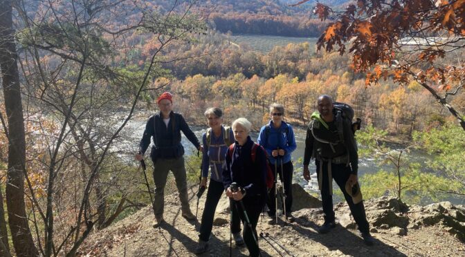
Winter hikes in the mountains intimidate us. Not so much the hiking itself — who doesn’t love tromping through a forest carpeted with snow? Rather, it’s simply getting to the trailhead. The prospect of icy mountain roads, of road closures, of other drivers who don’t know how to drive on icy roads. Why run the risk?
Thing is, not all mountain hikes require driving high into the mountains to reach. Below are five of our favorite winter mountain hikes that offer the thrill of a winter in the mountains minus the angst of driving there.
Doughton Park
Roaring Gap
Think of Doughton Park and its 30 miles of hiking trail and you think of the Blue Ridge Parkway, which is often closed by ice for long stretches in winter. Not if you enter from the Longbottom Road access, which sits more than 1,800 feet below the summit. From the trailhead you can pickup three trails to the park’s mountaintop meadow: Cedar Ridge (our pick), Grassy Gap Road and Flat Rock Ridge. Using those trails plus the Mountains-to-Sea Trail/Bluff Mountain Trail at the top, you can create loop hikes of up to 18 miles. And because you’re hiking up the Blue Ridge escarpment’s steep northern and eastern exposure, snow tends to stick around a bit.
More info here
Mount Mitchell Trail
Burnsville
Not even the highest peak east of the Black Hills is immune to a winter assault. Although Mount Mitchell State Park, named for 6,684-foot Mount Mitchell, is frequently closed because it’s accessible via the Blue Ridge Parkway, the 5.5-mile Mount Mitchell Trail remains open to the hardiest — and best prepared — of explorers. The trailhead off the Toe River is below 3,000 feet, meaning it can be dry and pleasant at the base, as wintry as it gets 3,700 feet up on the summit. The first 3 miles or so of this trail are surprisingly mellow, a climb to be sure but eased by switchbacks. Then, it hits some troughs that are not only steep but can fill with ice. Be exceptionally cautious and well prepared for this hike.
More info here
Linville Gorge, Shortoff Mountain
Nebo/Lake James
From the well-known gorge’s West Rim, the trails all descend into the gorge, offering little in the way of views (not to mention that access via the “Kistler Memorial Highway,” a gravel pothole-fest is sketchy in the best of weather). The main access on the East Rim is Tablerock Mountain, which closes in winter. That leaves the 2-mile hike up to Shortoff Mountain on the East Rim’s south side as your best option. Note: this is not a 2-mile cakewalk: it’s steep in spots and gets rutted. But it’s southern exposure keeps it mostly clear of snow and ice, and the reward — another couple miles of hiking along Shortoff’s rocky, pine-pocked plateau is well worth the effort.
Learn more here
Rich Mountain Loop
Hot Springs
What could be better than beginning and ending a hike in Hot Springs, elevation 1,500 feet? The first 8 miles, on the Appalachian Trail, is a steady climb, and includes an awesome view of the French Broad River and the town of Hot Springs (see photo). Continue climbing through a mature hardwood forest and mountain clearings. Pass Tanyard Gap and continue to the spur to the fire tower atop 3,700-foot Rich Mountain for more great views on a clear day. There’s a slight retreat on the AT before picking up Roundtrip Ridge Trail for the mellow hike back to town. Twice on this hike we’ve encountered a well-defined snow line at about 2,500 feet. 12.3 miles roundtrip.
Learn more here.
Art Loeb Trail: North End to Shining Rock Ledge
Canton
Consider this a backdoor entrance into the Shining Rock Wilderness in winter. Most of us are used to entering Shining Rock via the Black Balsam access off the Blue Ridge Parkway. Alas, this is the highest run of the parkway, generally above 5,000 feet in elevation, and it’s closed by snow and ice much of the winter. Enter via the north entrance, at the Daniel Boone Boy Scout Camp and the low elevation road is generally clear. You begin to make up elevation quickly once on the trail, gaining nearly 2,000 vertical feet in the first 3.5 miles up to Deep Gap — and nearly 1,000 more vertical feet if you continue the mile or so to the summit of 5,968-foot Cold Mountain. At Deep Gap, you also have the option of hiking south of the Art Loeb Trail along the Shining Rock Ledge (it’s 2.5 miles along the Ledge to Shining Rock).
Learn more here.
