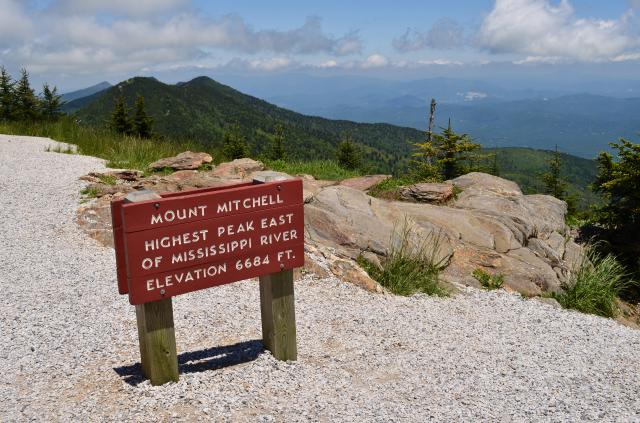
Some of us don’t mind hiking in the heat. Switch to cotton, freeze your water bottle overnight, use your trekking poles as spider web vanquishers … . Sure, you work up a nice glow. But you’re on the trail, and really, it’s not unbearable.
We recognize, though, that not everyone is inclined to keep on hikin’ between Memorial Day and Labor Day. We also recognize that along about the Fourth of July weekend, the aforementioned cool-weather hikers are starting to undergo withdrawal. They get out their phone and stare longingly at those photos from the beginning of the year, when you were bundled in fleece. Ah, the good cold days.
We can’t magically make it cold. But we can direct you to some hikes where it feels less like summer. In some cases, a lot less. As a rough rule of thumb, the temperature drops about 3.5 degrees for every 1,000 feet of elevation. So if it’s 90 in Raleigh (elevation 315 feet), it’s in the upper 60s atop Mount Mitchell (elevation 6,684 feet).
Lesson one: hike higher, hike cooler.
Lesson two: you needn’t go as high, provided you’re hiking near cool waters. Waterfalls, pools on mountain creeks, that sort of thing.
With those two guiding points in mind, we offer 5 high country spots where fair weather hikers can stretch their legs without working up a drenching sweat. You might even want to take along a fleece.
Learn more about those hikes, here. Or, consult the entries listed in either our “Backpacking North Carolina” or “100 Classsic Hikes in North Carolina.”
1. Shuckstack/Lost Cove/Lakeshore Loop
11.6 miles
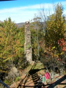
Great Smoky Mountains National Park, Fontana Village
Part of what makes this hike feel cool is that you start at the Fontana dam and climb immediately, gaining 2,280 feet in 3.5 miles. Yes, as you might suspect, you work up a good glow. But once you top out at Sassafras Gap, that glow becomes your cooling agent as you descend Lost Cove Trail through dense woods, then return via the Lakeshore Trail along the cooling waters of Fontana Lake. Unrelated note: I’ve seen both black bear (not uncommon in the Smokies) and wild boar (less common) on this hike.
For details: Trip No. 21 “Backpacking North Carolina”.
2. Hunt-Fish Falls/Gragg Prong Loop
7.3 miles
Wilson Creek area, Pisgah National Forest, Mortimer
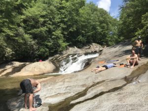
Wilson Creek proper gets more crowded than a water park on a summer weekend due to the proximity of parking (if you can find it) to the water. But venture deeper into the Wilderness Study Area and you’ll find better water and fewer people. You’ll just need to invest a little sweat equity. Here’s what you do: hike the Hunt-Fish Falls Trail down to the Lost Cove Trail and go right. You’ll cross the creek, then keep an eye out for the Timber Ridge Trail on your left. Take it uphill (you’re investing in that sweat equity at this point), then go right on the Lost Cove Trail (it loops back around). Take it to Gragg Prong, hike downstream for less than a mile and you’ll have your choice of choice mountain pools to swim in. Related note: If you see a snake in the water, it is likely a harmless northern banded water snake; it is not a cottonmouth, which doesn’t live within a couple hundred miles.
For details: Trip No. 8, Backpacking North Carolina.”
3. Basin Creek Trail
12 miles
Doughton Park, Longbottom Road access, Roaring Gap
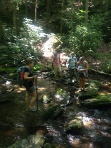
The mile-and-a-half approach from Longbottom Road to Grassy Gap along Grassy Gap Creek is flat, a good opportunity to warm up the legs. There, pick up the Basin Creek Trail, which climbs in bursts along its frisky namesake creek (a creek that flooded in 1918wiping out the entire Basin Cove Community). Multiple crossings help you keep your cool; several pools along the way allow for a more immersive cooling event. Your carrot: the trail terminates at the Caudill Cabin, which survived the 1918 flood and was home to a family of 13. Stunning note: The Caudill Cabin is one room.
For details: Trip No. 11, “Backpacking North Carolina.”
4. Black Mountain Crest Trail
2-12 miles
Mount Mitchell State Park, Burnsville
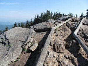
This is cool hiking, guaranteed. With much of this hike above 6,000 feet (reaching 6,684 feet), you’re looking at temperatures in the 60s on a 90-degree Piedmont day. From the main parking area, make the short-but-obligatory summit, via pavement, to Mount Mitchell, then head north across the main parking lot on the Crest Trail to Mount Craig. Craig is only a mile out, but it’s a challenging mile and there’s no shame in topping out and proclaiming, “I’m good, heading back.” Big Tom, though, is just a short distance beyond, and that would give you your third 6,000-foot peak for the day. Balsam Cone, Cattail Peak and Potato Hill lie beyond, before the drop into Deep Gap at just over 6 miles. Warning note: Remember, this is an out-and-back; making it to Deep Gap with zero energy for the return is does not constitute a successful hike.
For details: Hike No. 65, “100 Classic Hikes in North Carolina.”
5. Pink Beds
5 miles
Pisgah National Forest near Brevard
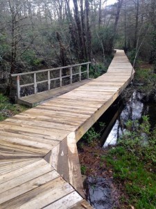
Look at a topo map of the Blue Ridge Escarpment north of Brevard and you’ll wonder, “What happened there?” Amidst a sea of tight, brown topographic lines is a sea of nearly unblemished green, a flat ledge on the escarpment known as Pink Beds. It’s a rare Appalachian bog through which the South Fork of Mills River runs, occasionally stopping to collect itself in a series of small ponds. A 5-mile trail circumnavigates Pink Beds, the wetter spots navigated via boardwalk. There’s the occasional meadow, some dense woods, precious little climbing. At just below 4,000 feet there may be cooler mountain climbs, but none as flat. Geographic note: Pink Beds got its name after early settlers cleared the land for farming, exposing an abundance of pink wildflowers.
For details: Hike No. 80, “100 Classic Hikes in North Carolina.”
