Editor’s note: We run a tweaked version of this hike every fall to help you avoid crowded trails in this, the most popular hiking season.
Though most of us associate the start of fall with the passage of Labor Day, fall doesn’t officially start until Sept. 22, officially at 8:44 a.m. EST. This week has definitely gotten us in the mood, with high temperatures in the 70s, lows in the 50s.
In other words, perfect hiking weather. Perfect weather that will bring out the fair weather hikers. That is, everyone who hikes once or twice a year will be hiking come fall.
What’s a solace-seeking hiker to do?
Avoid the trails most traveled in favor of the spots that are just as nice, but not as well known. Spots such as:
Crowders Mountain State Park: Boulders Access
Kings Mountain (near Charlotte)
Ridgeline Trail
Trail: 7+ miles
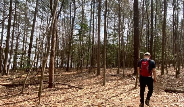
Being so close to Charlotte, it’s no surprise that Crowders Mountain is loved to death. But that lovin’ is mostly at the Sparrow Springs Access and at the Linwood Road Access. The Cinderella access at Crowders Mountain: the Boulders Access near the South Carolina line. Here, you can pick up the Ridgeline Trail and hike 5.5 miles north to The Pinnacle, or head south into South Carolina and miles of hiking at Kings Mountain State Park and Kings Mountain National Military Park. And if it’s a particularly nice weekend and the Boulders Access is crammed, N.C. State Parks offers you a backup plan.
Learn more here
Doughton Park: Long Bottom Road Access
Laurel Springs
Grassy Gap/Basin Creek trails
Trail: 4.8 miles (one way)
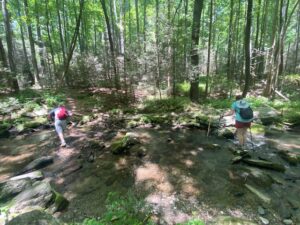 Talk about being loved to death! The Blue Ridge Parkway must be the Southeast’s most sought-after date come autumn and the fall color show. Fortunately, Doughton Park has 30 miles of trail, including a 4.8-mile stretch that runs from the base of the escarpment up Basin Creek to the Caudill Cabin. The Grassy Gap portion is relatively flat, making for a nice warmup; Basin Creek adds elevation, but along a rocky, tumbling creek, the beauty of which is more likely to take your breath away than the hike itself.
Learn more here.
Hanging Rock State Park: Tory’s Den Access
Danbury
Tory’s Den Trail
Trail: 2.4 miles (one way)

If you’ve never been to Hanging Rock State Park and the 1.3-mile trail to the top of its namesake knob, here’s a visual: picture an anthill and its residents in an endless line heading up and back. From the Tory’s Den Access off Tory’s Den Road, however, you may see an equestrian or two along the way, but no ants. If you’re itchin’ for a view when you reach the Moore’s Wall Loop Trail, head north on that trail for a little more than a mile to the outlook atop Moore’s Knob.
Learn more here.
Jones Lake State Park
Elizabethtown
Bay Trail
Trail: 4 miles

Keep this one tucked in your back pocket for that first fall day when the temperature isn’t likely to get out of the 50s and there isn’t a cloud in the sky. On such days, the popular state parks will have to close before they open; you, on the other hand, will be enjoying a brisk walk around Jones Lake on a trail that goes through pine savannah and dense coastal woods as it circles this rare Carolina bay. Total elevation gain? Maybe 2 feet.
Learn more here.
Medoc Mountain State Park
Hollister
Trail: 10 miles of hiking trail, another 20 miles of multi-use

Despite the fact it’s just an hour and a half drive from the Triangle, Medoc Mountain continues to fly under the local hiking radar. Why? Beats us. The 10 miles of hiking trail offer a mix of hiking along a Piedmont stream, summiting 300-foot Medoc Mountain, exploring the first vineyard in the country (or what’s left of it). Plus, if you don’t mind sharing, another 20 miles of equestrian and mountain biking trail will give you the long aerobic workout you seek on a 60-degree day. Scenery and solitude, rarely found in the same place but you’ll find it here.
Learn more here.
Mountains-to-Sea Trail: Falls Lake Day-hike Section H
Shinleaf Recreation Area, Wake Forest
3 miles (one way)
The statewide Mountains-to-Sea Trail spends 60 miles along Falls Lake north of Raleigh, with 18 access points. One of the most accessible sections of the trail is at the Shinleaf Recreation Area, where you can hike east or west. We favor hiking east, through a carpet of running cedar, beneath a mature hardwood canopy and in and out of the coves along the lake’s south shore. This is a rolling section of trail: you’ll find numerous climbs, none long or steep, that provide enough variety to keep your attention. Hike to NC 98, then return the way you came.
Learn more here.
Mountains-to-Sea Trail: Falls Lake Day-hike Section T
Red Mill Road in northern Durham County
Trail: 4.2 miles (one way)

There’s something oddly enchanting about this stretch of the MST. Heading west from Red Mill Road, the trail makes its way for a couple miles through bottomland forest, influenced by the nearby Eno River but far enough way that you don’t know it’s there. Then, the trail climbs a bluff overlooking the Eno. It’s not particularly high — maybe 70 feet above the river — but it’s just enough that in the winter, the canopy bare, you have a long view to the north (you can see the Eno below). One of the more quiet stretches of the MST through the Triangle.
Learn more here.
Pilot Mountain State Park: Pilot Creek Trail
Pinnacle (north of Winston-Salem)
Pilot Creek Access
Trail: 3.3 miles (one way)

The relatively new 3.3-mile Pilot Creek Trail wraps around the base of the Pilot Mountain’s northern flank, picking up it’s namesake creek and traversing the rocky terrain that gives Pilot Mountain it’s mountain-like appeal. The trail ends at the camping area. It’s a worthy hike on its own, but if you’re hankerin’ for the summit, you can pick up the Grindstone Trail to the top.
Learn more here.
Seven Mile Creek Natural Area
Hillsborough
Trail: about 1.5 miles

Mature forest, a little-known Piedmont creek, a vast field of ferns, an old cemetery, and natural surface trails wide enough and smooth enough to accommodate hikers of just about any ability. Orange County’s Seven Mile Creek Natural Area is one of those quiet getaways for when you want to getaway quick, but not necessarily go far. Escape comes quickly at this 360-acre preserve, where the creek, a tributary of the Eno that mimics the latter’s mountain vibe, is a 10-minute walk from the car. And located on a gravel road that’s off a gravel road that’s off a remote two-lane, it tends to be a nicely kept secret.
Learn more here.
Shallow Ford Natural Area
Elon
Trail: 5 miles in four loops
With four loop trails, you can go short or long at Shallow Ford Natural Area. Got some non-hikers in tow and need to keep it short? The 3/4-mile Basin Creek Trail gives you a nice introduction to the preserve’s bottomland forest. Tack on the 2.2-mile Hidden Hill Trail and you’ll explore meadows and upland hardwoods. Another 2.2-mile option: the Homestead Trail, which takes you along a particularly rocky and impressive stretch of the Haw River. Hike it following a good rain and you’ll develop a keen appreciation for this river that once supported a vast textile mill industry.
Learn more here.