Last week, I wrote of the need to get out — at least once — on a sanity-saving hike over the holiday season. Because we realize you have a lot going on this time of year, and because we realize the one chance you might have to venture out should be extra special, we offered to come up with the perfect hike, just for you. To make that happen, we asked a few questions, such as: How long is your ideal hike? How far are you willing to drive? And what do you hope to find along the trail? You made my job easier by being pretty much in synch regarding your needs.
For instance, the majority of you — 75 percent — like a hike that’s 5-6 miles long. 37.5 percent said you’d be willing to drive up to an hour for that hike, another 25 percent said you’d drive up to two hours. You like a trail with a view, you like to walk along water, and you don’t mind a hearty climb. Since all of you who responded live in the Triangle, that narrowed the options.
Before I share my suggestions, one caveat: Great views are hard to come by in this neck of the Piedmont. There are some good ones, which I’ll get to, but “great”? That would be stretching it. In the interest of being honest, I must refrain from describing any view as great. That said …
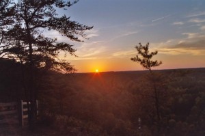
1. Occoneechee Mountain State Natural Area
Hillsborough
3 miles (according to the park website)
Yes, this is about half of the trail length you requested (the web site says three miles of trail total, but it seems longer). But it does offer the best view from a hiking trail in the Triangle. To reach that view, head west on the Occoneechee Mountain Loop Trail, which hugs the perimeter of this 190-acre preserve. Initially, the trail snuggles up to a noisy I-85, but in less than a half mile the trail veers north, then turns east where it buddies up to the Eno River. This is the topographical low point of the hike, but its scenic zenith: the 30-foot cliff immediately to your south is home to Catawba rhododendron, mountain laurel, galax and other plants more common to the Southern Appalachians. It’s a brief encounter with the mountains: quickly, the trail climbs to the Brown Elfin Knob Trail (named for a drab but rare butterfly rarely found at this low altitude), then climbs to an overlook made possible buy a long-abandoned quarry operation that hacked away the northwest flank of the mountain: On a clear day you can see Mebane. (This is not the highest spot on the mountain; Occoneechee peaks out at 867 feet, but the view isn’t as good.) A lot to see on Occoneechee Mountain, and if you’re heck-bent on putting in 6 miles, simply do the trail in reverse.
For directions and more info: Go here.
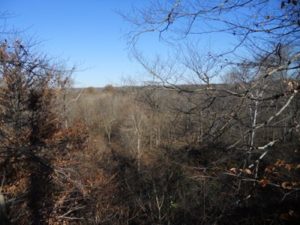
2. Falls Lake Trail, Sections 22 and 23
Durham County
8.7 miles
OK, so this one is a little more than 5-6 miles (this isn’t an exact science, you know). Section 23 is 4.2 miles and includes the good view; Section 22 has some good water sections. Both are worthy, but if together they’re too long, pick your preferred feature and do it. Section 23 runs along the Eno River from Pennys Bend Nature Preserve downstream to Red Mill Road. A little over a mile from Pennys Bend the trail suddenly finds itself atop a bluff maybe 50 feet above the Eno. It’s not that high, but high enough come winter to give a nice view of the countryside to the north. Section 22, which begins at Red Mill Road and runs a crescent before returning to Red Mill Road, includes nice passages along and above some more remote inlets of Falls Lake. On either section, the odds of seeing too many other hikers are slim. This is your best bet for solitude.
For directions and more info: Here’s a post about Section 23; for good (free) maps of the trail, check out Art’s Hiking Maps.
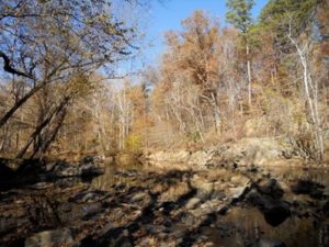
3. Eno River: Guess Road to Cabe Lands Access
Durham
6.2 miles
6.2 miles — pretty close, eh? And such a great trip you won’t even notice the extra two-tenths of a mile. This stretch, part of the Mountains-to-Sea Trail, runs along the south bank of the Eno River and offers some of the best scenic hiking along the popular waterway. From the Cabe Lands Access head east (downstream) and into some of the most vertically challenging terrain along the Eno. Truth be told, they’re just some quick ups-and-downs, but the passages take you into cozy ravines, atop bluffs offering good peeks at the Eno below, and through bottomland forest. It’s an Eno highlight reel all the way down to Guess Road.
For directions and more info: Go here to find out more about Eno River State Park and info on how to get to the Cabe Lands area. Here’s what you do at Guess Road end of the hike: The trail climbs up to this busy four-lane, crosses the bridge and switches from the river’s east bank to the west. Just on the opposite side of the bridge is a nondescript red brick house which is, in fact, the world headquarters of the Eno River Association. A good place to park your shuttle vehicle.
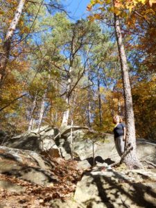
4. Umstead State Park: Company Mill Trail
Raleigh
5.8 miles
Ha! Nailed this distance on this one. This is probably the most popular trail in a very popular (800,000-plus visitors a year) park. At least the first mile is: The trail crosses three mild ridges on its passage down to Crabtree Creek. This is the destination for a goodly number of Company Mill hikers, especially those with kids and dogs. Linger a moment at the creek, where a breached mill dam creates a minor waterfall, then cross the green bridge and go right. The trail follows Crabtree Creek for a spell, then climbs, crosses a bike and bridle trail, touches Sycamore Creek, then returns, bringing you back to the bridge over Crabtree and your mile-long climb back to the trailhead. A popular trail for good reason.
For directions and more info: Go here.
5. Raven Rock State Park: Raven Rock Loop Trail, et all
Lillington
2.6, 4.1, 5.3, 5.3+ miles
I take it back: there is one great view in the bunch — the one from atop Raven Rock, reachable on the 2.6-mile Raven Rock Loop Trail. Raven Rock is a 150-foot bluff overlooking the Cape Fear River. An viewing platform offers a 180-degree views up and down the Cape Fear and north into relatively flat terrain where the Piedmont and Coastal Plain mingle. Tack on the adjoining 1.5-mile Little Creek Loop Trail for a surprisingly green hike (holly and mountain laurel) during an otherwise drab time of year. A wander down the Fish Traps Trail (0.6 mile, one way) takes you onto an outcrop in the Cape Fear, and if you’re especially energetic, the 5-mile Campbell Creek Loop Trail takes you away from the masses drawn to the park’s featured, namesake attraction. About an hour’s drive from I-40 and Wade Avenue in Raleigh.
For directions and more info: Go here.
Good post, Joe. Thanks.
Re the issue of what constitutes a view: For me, it doesn’t have to be an up high and see for miles view. It just needs to be something visually interesting that gives a break from the green (or brown-and-gray) tunnel that a trail can get to be. On Falls Lake Trail Section 22, for example, I look forward to the views of some interesting old buildings just off the trail, and the railroad causeway over the mouth of Ellerbee Creek. All of the hikes that you selected have some of that kind of view, so don’t worry about good vs. great.
You’re right, Chris. That old tobacco barn and the giant white oak that come out of nowhere are especially good views. There’s also a nice view of the lake on a small bluff in through that area.
Good way to get started is with the First Day Hikes planned at most NC state parks on Jan. 1. Brief hikes guided by rangers. More information coming on this on the NC state parks website http://www.ncparks.gov and its Facebook page. (Charlie Peek, NC Division of Parks and Recreation)
Great, Charlie! Thanks.
I hiked Ravens Rock a few weeks ago and it was beautiful. There were some nice surprising rock formations especially for that part of N.C. I drove over 2 hours to hike it and it was worth it.