I was on a bike ride early Saturday, headed out of town on a route I’ve been doing about twice a week for most of the summer. A mile into the ride, settling into my groove, I noticed, with the binocular from Vortex I’d bought, a car with a kayak rack parked in a gravel pullout on the opposite side of the road. Just beyond, I noticed a narrow clearing in the lush woods leading down to an oxbow in the Eno River, a spot where the river slows pools up. I didn’t think much of it and pedaled on.
The next day, though, I started putting two and two together: car with kayak rack + roadside pullout + clearing to a slow spot in the river: River access? I wondered.
I went back and discovered it wasn’t. But from the clearing, I could see a kiosk on the far side of the oxbow and discovered that by driving another hundred yards up the road there was an access that gets you on a stretch of the river that’s runnable even in the dry days of summer. A little investigation, a big payoff.
A little investigation, a big payoff. That’s my philosophy for adventure, whether I’m writing a book or searching for a new place to lead a hike. Like most hikers, I have my favorite trails that I tend to return to. But when I see a potential opportunity — a break in the trees near a roadside pullout, for instance — I take a moment to explore. Here’s how I found some of the spots we’ll be exploring in the next few months.
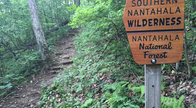
Standing Indian Recreation Area, Nantahala National Forest, Franklin. Researching “Backpacking North Carolina” a decade ago, I discovered an area west of Franklin that appeared to have a fair number of trails — nearly 80 miles worth, it turned out — contained in a large, horseshoe-shaped basin. Curious, I started out from the Backcountry Information Center intending to do a quick afternoon hike. I wound up camping for three nights and covering 30 miles doing not only the Standing Indian Loop (Trip No. 27), but probing a variety of trails along the way.
Linville Gorge, Pisgah National Forest, Linville. When we first did the so-called “Is this all ya got” loop, I was already relatively familiar with the 25-mile route through previous day hikes and backpacking trips. What I didn’t know was where there might be a good bailout route should a hiker get into trouble. A month before our visit, I hit a couple areas that seemed to have potential, including the lower crossing of the Linville River, on the Mountains-to-Sea Trail. After crossing the river headed west, I hit a T and was informed by the map that to stay on the MST, I should go right. But what was to the left? I wondered. So I followed the old roadbed for less than a mile, to a house on Fonta Flora Road. Later, driving the area, I discovered that Fonta Flora Road fed into another road that, shortly hit NC 126. We had our bailout route (which we would need four weeks later to evacuate a heat-exhausted hiker).
South Mountains State Park, Connelly Springs. South Mountains State Park, at more than 18,000 acres, is the largest state park in the North Carolina system. It’s also among the least known. Located some 13 miles south of Morganton, it’s not on anyone’s beaten path, but it seemed to have a good infrastructure for backpacking, especially first-timers: designated camping areas, fire rings, picnic tables — even privies. Primitive, but not too. I spent a weekend exploring the 40 miles or so of trail and discovered a two-night route that wasn’t too taxing, but didn’t sugarcoat what the mountain backpacking experience was about. (I should mention that we occasionally experiment with different routes, but still prefer the one that takes us from the base to the Jacob Branch campsite the first night, the Sawtooth campsite the second.)
Wilson Creek, Pisgah National Forest, Mortimer. We love taking folks to Wilson Creek, the 11,000-acre jumble of rock and water at the base of Grandfather Mountain, introducing them to our finds, then encouraging them to make discoveries on their own. Among our favorite “graduation” stories is that of Bob and Henry. Both did their first trips up there with us, were intrigued, then decided to explore on their own. Afterward, Henry tried to show me on a map where they’d been. They’d done a 35-mile loop that involved a night near South Harper Creek Falls, a night near Hunt-fish Falls, some time on the Mountains-to-Sea Trail, and maybe visited North Harper Creek Falls, who knows. Anyway, they made it out — and they’re headed back. Our favorite Wilson Creek discovery? Heading out a trail to nowhere on Big Lost Cove Ridge. Hmm, I thought, looking at the map, it just ends. I took it and found out why: there’s a rock outcrop — a cliff — that stands 1,400 vertical feet above Lost Cove Creek.
Birkhead Mountain Wilderness, Uwharrie National Forest, Asheboro. We end with an instance where being a little more inquisitive would have been a good thing. For years, I hiked the Birkhead Mountain Wilderness Loop starting from the Robbins Branch trailhead. Then, a new trailhead opened off Tot Hill Road. It cut about 20 minutes off the travel time for most of our hikers, so I scheduled a hike from that trailhead — without scouting it first. Turns out that while the Robbins Branch access tapped right into the loop, it took the then-new Tot Hill access two miles to reach the loop. When we were a little over halfway through the hike, a hiker in our group announced, “Hey, my app says we’re at Mile 7.5 — we’re about done!” We weren’t, but I was.
See an opportunity, take it. You may discover your next favorite hike.
Join us!
Learn more about the locations mentioned above and our upcoming visits, here:
- GetHiking! Classic Escapes: Standing Indian and the AT
- GetBackpacking! Linville Gorge: Advanced Skills
- GetBackpacking! Intro to Backpacking (South Mountains State Park)
- GetBackpacking! Wild, Wonderful Wilson Creek
- GetBackpacking! Weekend Quick Escape: Birkhead Mountain Wilderness