To follow along with the trails mentioned below, download a copy of the Raleigh greenway map here.
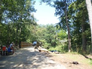
The first 8 miles of the the Neuse Greenway Trail is all but 20-feet finished.
That’s the official word this morning from Raleigh Senior Greenway Planner Vic Lebsock. Officially, there’s only 20 feet left to finish, on a boardwalk a little over two miles south of the northern trailhead (off the old Falls of Neuse Road). A stretch under Capital Boulevard and greenway under the new Falls of Neuse Road — both of which were under construction a month ago — have been completed, Lebsock said. That means you could start from the southern trailhead, at the WRAL/CASL Soccer Complex off Perry Creek Road between Capital Boulevard and Louisburg Road, and travel unencumbered six miles upstream.
Lebsock couldn’t say when the 20-foot gap would be finished. He could say, “We hope to have the official ribbon cutting in November.” He also could say that while the trail officially isn’t open, there sure are a lot of people have discovered the greenway and are using it.
While the 20-foot-gap issue gets resolved, construction on most of the rest of the Neuse Greenway Trail should get underway within the next two weeks. Lebsock says construction should begin from Horseshoe Creek Farm (just across the Neuse River from where the aforementioned 8-mile stretch ends) south to near the Heddingham neighborhood, and from Anderson Point south to the Johnston County Line. Two remaining mile-long stretches are expected to go to bid by January.
Lebsock says the entire 28-mile Neuse Greenway Trail — from Falls of Neuse dam south to the Johnston County line — remains on target to be finished by the end of 2012.
“We’re right on schedule,” says Lebsock
In other Raleigh greenway news:

House Creek Greenway. This much-anticipated 2.9-mile greenway will connect the city’s Reedy Creek Greenway on the west with the 11-mile-long Crabtree Creek Greenway to the east. Lebsock says construction continues all along this stretch, which essentially parallels Raleigh’s Beltline (I-440). He said “unforeseen construction problems” have delayed reopening of Glen Eden Road, under which a pedestrian tunnel has been built (the tunnel, in addition to a tunnel under Lake Boone Trail, are both finished), and work continues on a connector greenway extending from Ridge Road that links into House Creek and the Reedy Creek greenways just east of the pedestrian bridge over the Beltline.
That connector plays a key role in a seemingly unrelated greenway two miles to the west. There, a greenway less than a mile long has been built along Edwards Mill Road by the N.C. Department of Transportation linking the Reedy Creek Trail with the RBC Center. As part of the House Creek project, the gates on the pedestrian bridge over the Beltline will be removed. Those gates are locked at night to prevent access to the Meredith College campus, through which the southeastern portion of the Reedy Creek Greenway passes (a new gate will be built in the pedestrian tunnel under Wade Avenue, through which the Reedy Creek Greenway passes). Using street connectors and greenways, it will be possible for people living inside the Beltline to take the greenway to Carolina Hurricanes games and other evening events at the RBC Center.
Lebsock says the entire House Creek project should be finished by March 2012.
Crabtree Creek Greenway extension to the Neuse River. Currently, the 11-mile greenway follows its namesake creek from near Duraleigh Road downstream to Milburnie Road. This four-mile project would link the Milburnie end with the Neuse River and Neuse Greenway Trail. Lebsock says stretch will likely go to bid in January or February, with completion targeted for the second quarter of 2013. (On the northwest end, the Crabtree Creek Greenway eventually will run to Umstead State Park and hook into the park’s 18-mile bike and bridle trail network.
Walnut Creek Greenway to New Hope Road. The Walnut Creek Greenway currently runs along the south side of Raleigh, from Lake Wheeler Road east to Worthdale Park. Eventually, greenway to be built through N.C. State’s Centennial Campus will link it with the Lake Johnson Greenway to the west. To the east, four miles remain before the Walnut Creek Greenway taps into the emerging Neuse Greenway Trail. Two of those miles, from Worthdale Park to South New Hope Road, will go out to bid in 30 to 60 days, according to Lebsock. That stretch should open by the end of 2012. Funding for the remaining two miles, from South New Hope to the Neuse, rests in the fate of a $40 million transportation bond that goes before Raleigh voters Oct. 11.
Honeycutt Creek Greenway: The 6-mile Honeycutt Creek Greenway will run from Strickland Road to Falls Lake, where it will connect with the Mountains-to-Sea Trail. Lebsock says a few final approvals and permits are needed for this trail, but that it should go to bid shortly and construction should begin in January. It is expected to be finished by the end of 2012.
Always love a greenway update. Is it possible to continue on past that 20 foot gap? Or is it something that’s going to force you to backtrack?
Too bad about the House Creek delays. At the last Raleigh BPAC meeting a Parks person (not Vic) said House Creek was due to be opened Oct. 19th. We made her repeat that about 5 times because it seemed so improbable, and I guess we were right to be skeptical. Although now I see that Glen Eden is scheduled to reopen on that date, so perhaps there was a misunderstanding about what was being asked. Still I wonder if any part of it will be completed this year. City website still has Wade to Glen Eden being completed in November (but then that was updated in April).
Using Greenways to get to the RBC Center sounds great. Unfortunately, even with the 440 bridge gate removed, the Greenways remain technically off limits after dark. I’m all for touting the transportation aspects of our awesome greenway system, but until they lift that restriction, it will be hard to find an RBC Center event that starts and ends in daylight hours. Perhaps the Art Museum, which seems the most likely problem area between Wade and RBC, can be encouraged to turn a blind eye toward after hours riders.
You can continue past the gap, but getting through the gap — which goes through a wetland — would be a sloppy, shoe-sucking challenge.
With all the recent rain, the crossing through the creek would be messy. However, you can use neighborhood roads to connect to the other side. Take the concrete trail (labeled as “Abbotts Creek” on Google maps) up to Grassy Creek Place, then right on Falls River Ave, then right onto Bedfordtown Dr (roundabout) and right into the new parking area and you’re back on the trail!
I noticed there was only a glancing mention of that pesky area of greenway between umstead and lindsay drive. Since the quarry deal fell through is there any hope at all that this section will ever be completed?
That’s a whole ‘nother set of phone calls, Bob. I’ll get on that next week.
Caught up with Sig Hutchinson, who has been acting as something of an intermediary between the various parties involved. He offered a “no comment,” which Sig rarely does. Hopefully that means some progress is being made. I’ll report back when I hear something more definitive.
You can ride around it from the North by taking the trailhead at Bedfordtown Road to Falls River Road to the trailhead at the end of Grassy Creek Road. Reverse if coming up from the South.
Thanks for providing directions both ways, Jules & LR.
Well, this story is now outdated! That 20 foot section is complete! Road end to end this morning. First time I was able to experience the south part of the trail. This trail is going to be just gorgeous in a few weeks when the leaves start to turn!
I hope they also can work on the last 100 feet or so of Abbotts Creak Trail boardwalk (it looks like they are making progress on it) so I can easily get over to the North Wake Landfill trails (some great trails over there!)
Great! I’m all for being quickly outdated!
I noticed last weekend that the “missing” section of Abbotts Creek Trail is now “complete” and passable (technically they were still working on handrails on the boardwalk/bridge). So now it’s possible to access the North Wake Landfill trails from the Neuse River trail without leaving the Greenway!
Nice! Thanks for the update, Lance.
trail is open all the way now from old Neuse River bridge to WRAL Soccer Park. Mile posts say approximately 6&3/4 miles from parking lot to parking lot.
i can only find a maximum length of 6+ miles, where are the other 2 miles that you keep referencing? thanx, and keep the updates coming
Where are you starting and where are you ending? Trail runs from the new parking area at the base of Falls dam downstream to the WRAL soccer complex. And how are you measuring the trail? Pedometer? Bike computer? GPS?
using gps and cateye miti8 on my mountain bike. i start at the soccer complex entry way
(by the way, a bad location on weekends to access the trail) adjacent to field #7 and proceed to the end at falls of neuse road by the dam. the last mile marker before the complex i believe reads 6 1/4 miles so it’s even marked at that distance. i’m not complaining, i’m very thankful, just want to know where the other 2 miles might be. thanks for answering.
A.J. — I haven’t had a chance to map the whole trail yet (I’ll do that next week), but from what I’ve pieced together it looks like the actual number may be closer to your figure (my partial figures come up to 6.46, and I’m guessing I’m not missing much more than a quarter mile). I’ll report back with full numbers. Thanks for the vigilance!