Soon — really! — it will start cooling down and our trails will become more crowded. Not the typical crowds that we expect every fall. Rather, the typical fall crowds plus the legions of folks who used to watch college football on Saturdays, but, we’re pretty sure, won’t be this fall.
Don’t let this news torpedo your hopes for a robust fall hiking season, arguably the most popular season for hiking in our neck of the woods. Granted, you might not want to drive to the Visitor Center and start your hike from there (after waiting 5 hours to get through the park gate). Instead, you’ll want to pursue the lesser-used access points to some of your favorite spots. The back doors, if you will.
Here are five of our favorites.
1. Umstead State Park
Raleigh
Bike & bridle trailhead
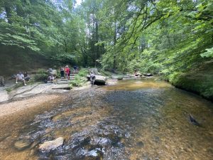
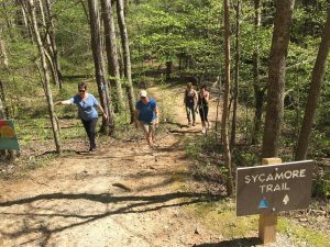 Umstead, located in the heart of Raleigh, is among the most popular state parks in North Carolina. How can there be a backdoor to such a well-loved location? “Backdoor” may be pushing it in this case, but even on the busiest weekends we’ve been able to at least find a parking spot at the bike & bridle trailhead deep inside the park. We’ve long preferred this trailhead because of it’s relatively remote location, and the fact that from here we can pick up not only the 13-mile bike & bridle trail, but also the best portion of the Sycamore Trail (about 4.5 miles), which connects to the Company Mill Trail.
Getting there: Enter the park from the US 70 (Reedy Creek) entrance. Drive past the Visitor Center (closed) and take the first left, on Maintenance Road. Go a short distance and turn Right on Group Camp Road (gravel). Just past the stone bridge, go Left on Sycamore Road, which ends at the B&B trailhead.
More info here.
2. South Mountains State Park
Connelly Springs (south of Morganton)
Several options (read on)
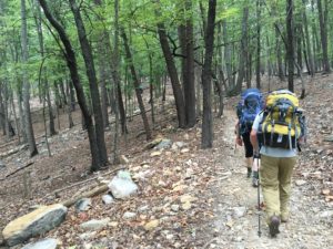
Leaving South Mountains after a backpack trip in July, we counted 40 cars queued up waiting to enter the park through the main entrance. It was noon on a hot Sunday, a day when South Mountains is swarmed for its water features. We’re guessing that one or two of the cars may have actually made it in. We’re guessing, too, that many more didn’t need to wait because they went in via a variety of secondary entrances, including those off of, or at the ends of: Rich Mountain Road, Watershed Road, Branstrom Orchard Street (the Clear Creek Lake Access), and several access points off Roper Hollow Road in the adjoining South Mountains Gamelands. Our favorite: take the gravel Roper Hollow Road to the gate near High Peak (it’s as far as you can drive), then hike a nicely wooded stretch about 5 miles to the park boundary, at the junction of the Lower CCC and Benn Knob trails. Be advised that these are game lands, with hunting allowed between Labor Day and Memorial Day.
Getting there: Your best bet is to pair the online South Mountains State Park map with Google Maps to find these access points. Yes, it involves some homework; another reason you won’t see many people at these accesses.
More info here.
3. Hanging Rock State Park
Danbury
Downtown Danbury entrance
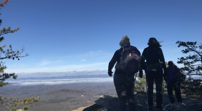
Imagine having the high peaks of Hanging Rock to your lonesome. If you’ve been to Hanging Rock on a fall weekend, you’re thinking this truly is a pipe dream. In fact, from the end of Sheep Rock Road in Danbury you can pick up a trail that heads past the water tower, then climbs to the ridge and the first of the Three Sisters, the park’s lesser-known peaks. After a mile climb, the three sisters are spread over the next mile and a quarter. There’s no official trail; just keep in mind that you’re climbing the three high points along the ridge. It’s about another mile of off-trail hiking before you tap into the Hanging Rock Trail and the short climb up to Hanging Rock.
Getting there: From Main Street/NC 89 in downtown Danbury, keep an eye peeled for Sheep Rock Road (it’s between Danbury Baptist Church and Danbury Community Church). It’s less than a mile to the gated trailhead.
More info here.
4. Raven Rock State Park
Lillington
Avents Creek Access
Raven Rock has been one of North Carolina’s state parks plagued by recent overcrowding — at least that’s been the case in the main part of the park south of the Cape Fear River. On the north side, at the Avents Creek Access, you’ll find fewer people, many of whom will be atop horses. Still, the West and East loops, both four miles, make for relatively quiet hiking — at least outside Jumping Fish Falls, a surprisingly robust (for the Piedmont) waterfall with two drops and generous pools. Hike the more scenic (parts have an Appalachian feel) West Loop first; if you’ve got another 4 miles in you, the East Loop Trail also originates from the parking area.
Getting there: 1580 River Road, Fuquay-Varina.
More info here.
5. Pilot Mountain State Park
Pinnacle (north of Winston-Salem)
Pilot Creek and Pinnacle Hotel Road/Culler Road accesses
Pilot Mountain has long been known for the traffic jams that develop on fall and spring weekends, with cars waiting up to a half hour to find a parking spot at the summit. Park planners apparently recognized that some of us don’t mind earning the views associated with Pilot Mountain — of the Blue Ridge Mountains to the west and north, the rolling Piedmont to the east and south — or forgoing them altogether, so they created another six access points to the park. Our favorites are the Pilot Creek and Pinnacle Hotel Road/Culler Road accesses. From the Pilot Creek access, the 3.3-mile Pilot Creek Trail wraps around the base of the mountain’s northern flank up to the camping area. It’s a worthy hike on its own; if you’re hankerin’ for the summit, though, you can pick up the Grindstone Trail to the summit. From the Pinnacle Hotel Road Access, pick up the 4.3-mile Mountain Trail, which wraps around two-thirds of the mountain’s base: connect with the Grindstone Trail to either complete a roughly 6-mile loop, or take it to the summit.
Getting there: Pilot Creek Access: 382 Boyd Nelson Road, Pinnacle; Pinnacle Hotel Road/Culler Road Access: 134 Culler Road, Pinnacle.
More info here.
Explore more
Check out our guides to exploring three of the backdoor options mentioned above by clicking on the appropriate link.