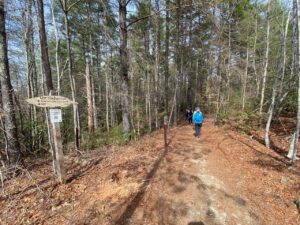
“Where are all the rocks and tree roots?” Kimberly asked about three miles into Sunday’s hike?
 Where, indeed? And that raised another question: the ill-equipped — in every way imaginable — hikers whom we’d passed heading up rugged and exposed Shortoff Mountain earlier that morning? Why weren’t they on this friendlier trail instead? Perhaps because they don’t know it exists?
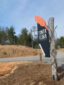
We were hiking the Fonta Flora State Trail, one of nine state trails in North Carolina. You likely know of one of the nine — the statewide Mountains-to-Sea Trail. But the other eight? Probably not.
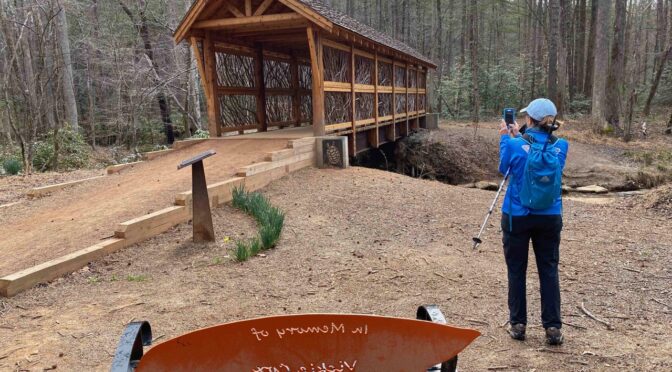
Take the Fonta Flora. Established in 2015 by the State Legislature, the Fonta Flora is intended to run about 60 miles, tracing the base of the Blue Ridge escarpment from Morganton west to Asheboro, with stops along the way in Old Fort, Black Mountain, and Swansboro. On this, our maiden voyage, we had lots of questions. Starting with, Where are all those rocks and tree roots? This multi-use (hiking, biking) trail was nearly devoid of obstructions. It also easily conformed to the State Trails grade maximum of 10 percent; with prudent use of gradual switchbacks, I doubt the grade reached half that.
 We did a little more than 3 miles of the Fonta Flora, picking it up from a trailhead at the base of Shortoff, where Wolf Pit Road Ts into NC 126, and hiking to the County (Burke) Park trailhead. There, we caught a connector trail that piggybacked on the MST Connector (or is it the other way around?) back to Wolf Pit and our cars, for about 5 miles.
Though conceived a little more than five years ago, there’s already 20 miles — roughly 25 percent — of the Fonta Flora complete from Lake James State Park east. (There’s also some completed trail near Old Fort and in Morganton). In the trail-building world, that’s lightening fast development.
If you look on the NCParks.gov State Trails site, you’ll see that only 15.7 miles has been designated. There’s typically a lag, for various reasons, between when a trail is completed and when it receives State Trails designation. Thus, if you’re planning a visit it’s best to check the State Trails site to see who the state is partnering with to build the trail. In the case of the Fonta Flora, it’s Burke County, Duke Energy, N.C. State Parks, N.C. Wildlife Resources Commission, the communities along the way, private land owners along the way, and more. Again, in the case of the Fonta Flora State Trail, you would want to check with:
- Burke County’s Fonta Flora State Trail site (where you’ll also find trail maps)
- Fonta Flora State Trail Facebook page
- Destination By Design’s Fonta Flora page
As for the N.C. State Trails program as a whole? This week’s GetHiking! Southeast podcast interviews Smith Raynor, N.C. State Trails Planner, to learn more about the the program, the trails and their development. Check it out here.
N.C. State Trails
Learn more about the State Trails program on the State Trails web page. Then learn more about each trail at it’s website:
- Deep River State Trail
- Fonta Flora State Trail
- French Broad River State Trail
- Hickory Nut Gorge State Trail
- Mountains-to-Sea Trail (also see the Friends of the Mountains-to-Sea Trail website)
- Northern Peaks State Trail
- Overmountain Victory State Trail
- Wilderness Gateway State Trail
- Yadkin River State Trail
GetHiking! Southeast Podcast
Again, learn more about the N.C. State Trails program in this week’s GetHiking! Southeast Podcast interview with Smith Raynor, State Trails Planner. Give a listen here.