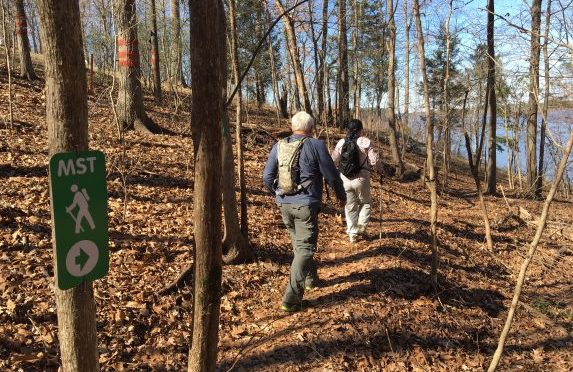
The best thing about hiking on a cold winter’s day? You can hike forever.
For starters, the cold itself is good incentive to keep moving. And the more you move down the trail the more you realize what a magical time of year this is in the woods. Winter’s sunlight knifes bright through a leafless canopy, illuminating a forest floor littered with coppery leaves. Somehow, those gray tree trunks manage to evoke a sparkle. Winter’s dry air cranks up the volume the season’s quiet. It’s an experience you don’t want prematurely ended on a 3-mile trail.
Today we share 10 of our favorite long winter hikes, in North Carolina and Virginia, and why they’re especially well-suited for the cold.
Company Mill Trail with Sycamore Loop
Umstead State Park, Raleigh
10 miles
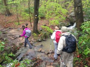
A figure-eight double lollipop loop that exposes you to the best of Umstead. Starting from the Harrison Avenue entrance (a k a the Reedy Creek entrance), take the Company Mill Trail over three small ridges to Crabtree Creek. Cross the green metal bridge and go right. You’ll follow Crabtree for a spell, climb to the bike and bridle trail that bisects the park and continue. Shortly, you’ll hit a kiosk indicating a short spur to the Sycamore Trail; do the 4-mile loop portion of Sycamore, then return to the Company Mill Trail and hike the portion you haven’t. Lots of up and down on this hike, but nothing grueling. Be advised that the first mile of Company Mill, down to Crabtree Creek, can be crowded on a nice weekend; it becomes less popular from there.
More info here
Birkhead Mountain Wilderness lollipop loop
Uwharrie National Forest, Asheboro
11.8 miles
Starting from the trailhead off Tot Hill Road, hike the Birkhead Mountain Trail south for two miles before hitting the popular loop that Boy Scouts, among others, have been using for years to cut their backpacking teeth. Where the Robbins Branch Trail enters from the right, continue straight on the Birkhead for two miles. (Despite the fact this is a designated wilderness, the trail is well blazed.) After two miles, go right on the Hannahs Creek Trail, where, for the first time, you abandon ridgelines in favor of passage along holly-clogged creeks. After a mile and a half, go right on the Robbins Branch Trail, which climbs a ridge before dropping to its namesake creek and rejoining the Birkhead after 3.2 miles. A great hike year-round, but winter is the only time you’ll catch views from the ridge.
More info hereMore info: For information on hiking the Uwharries, consult the “Uwharrie Lakes Region Trail Guide,” by Don Childrey, here; find a detailed trip description of the 22.9-mile hike from NC 24/27 to the Jumpingoff Rock Trailhead in “Backpacking North Carolina” (UNC Press, 2011).
Uwharrie National Recreation Trail
Uwharrie National Forest, Troy/Asheboro
26 miles
The Uwharrie National Recreation Trail has long been the default long hike for Boy Scouts in the Piedmont. In part, that was because it was the only game in town — and what a game it was, extending 50 miles at one point in the 1970s. The trail shrank in the 1980s and 1990s, but has since rebounded and is back up to about 40 miles. This stretch remains the classic Uwharrie Trail. Starting from the trailhead off NC 24/27, the trail heads north through what was once a mighty mountain range, with peaks topping 20,000 feet. Today, nothing along the trail reaches 1,000 feet, and while the climbs aren’t Appalachian, they’re more sustained than any you’ll find elsewhere in the Piedmont. It’s a good workout, and great training for backpackers prepping for a mountain trip. Several small waterways cross paths with the trail and can be filtered — when they’re running.
More info: For information on hiking the Uwharries, consult the “Uwharrie Lakes Region Trail Guide,” by Don Childrey, here; find a detailed trip description of the 22.9-mile hike from NC 24/27 to the Jumpingoff Rock Trailhead in “Backpacking North Carolina” (UNC Press, 2011).
Moore’s Knob and Indian Creek trails
Hanging Rock State Park, Danbury
11.5 miles
Starting from the Visitor Center, the 4.3-mile Moore’s Knob Loop Trail offers a dandy warm-up, passing the lake and bathhouse, then probing a tunnel of holly. About a mile in, it’s time to get down to business, with a long ridge ascent to Moore’s Knob. Continue the loop back to the Visitor Center for Round 2: the Indian Creek Trail descends to Hidden and Window falls, then drops its load of hikers before continuing another three miles to the Dan River. And back. Moore’s Knob offers the best views in the park and is considerably less crowded than the park’s namesake creek. Least crowded of all is Indian Creek Trail beyond the falls. An especially good option if you need to take a break midway — or you need to warm up.
More info here
Ridgeline Trail
Crowders Mountain State Park/Kings Mountain State Park (S.C.), Kings Mountain
12 miles
The 12-mile Ridgeline Trail joins two state parks — North Carolina’s Crowders Mountain and Kings Mountain in South Carolina, plus S.C.’s Kings Mountain National Military Park. Start from the North Carolina Visitor Center, hike to the base of Kings Pinnacle — don’t pass the opportunity to take the short spur to the top for great views— then continue south through rolling Piedmont countryside to the park’s Boulders Access, then on to the South Carolina state line (once the trail hits the Palmetto State, it is flat for the remainder). The ridgeline section may not seem sexy, but it’s the only trail in the park that’s not overrun; its quiet is amplified on a winter hike.
More info here
Mountains-to-Sea Trail: Eno River
Durham and Orange counties
10.2 miles
Starting upstream on the Eno at the Pleasant Green Access, hike up a bluff overlooking the Eno, around an abandoned quarry, through surprising stretches of steep climbs and sharp drops. Pass under Cole Mill Road and the trail mellows, heading through flood plain forest and occasionally taking a more upland route. At Guess Road you hike up to the bridge, stay on your side of the road, cross the bridge, then curl under the bridge to continue downstream. The beauty of this hike is that on parts of it, you’ll feel like you’re on a mountain hike, with quick ups and downs through narrow coves. And the rocky Eno does a good job of mimicking a mountain stream, especially after a nice rain.
More info here
Mountains-to-Sea Trail: Falls Lake
Wake and Durham counties
21.8 miles
The Mountains-to-Sea Trail runs 60 miles along the south shore of Falls Lake through the Triangle. With the trail broken down into 18 day-hike sections, ranging in length from just under a mile to nearly seven, there are plenty of long-hike permutations. Here’s a favorite. Starting from the Falls Lake ranger station off NC 50, hike west. Immediately, you are in the most remote stretch of the MST along Falls Lake, a nearly seven-mile run where signs of your fellow humans are rare (save for the remains of an old tobacco barn and what appears to have been a commercial chicken coop). The trail ducks in and out of coves on the lake, loses sight of it occasionally, has some boardwalked, swampy passages. At Little Lick Creek there’s an impressive pedestrian footbridge followed by an impressively narrow and long boardwalk. From there, it’s more hiking typical of a Piedmont hardwood forest. This 21.8-mile stretch concludes at the Hickory Hill Boat Ramp: no facilities but lots of parking. There is no water along the way; be sure to pack in plenty, even in winter.
More info: For more information on navigating this stretch and for scouting your own 20-mile hike on the MST at Falls Lake, go here.
Pilot Creek Trail
Pilot Mountain State Park, Pinnacle
6.6 miles (out and back)
Quiet and solitude are not qualities generally associated with Pilot Mountain. Over the last three years in particular, the summit of this park anchoring the west end of the Sauratown Mountain Range has become so popular that on weekends you can’t drive to the top, you must take a shuttle. Not the case when you hike from the Boyd Nelson Road access on the north side of the park. Here, catch the Pilot Creek Trail for a 3.3-mile hike that may not have the views the summit can offer, but is rich in rocky terrain and good winter vibes. At the 3.3-mile mark, if you’re hankering for those views, take the Grindstone Trail for a vigorous climb to the top. Or, do an about face for the 3.3-mile hike back.
More info here.
Great Dismal Swamp NWR
Chesapeake, Suffolk, VA
40+ miles
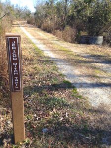
One of the most memorable days of hiking I’ve had in the last 20 years was on a bitter cold, stunningly sunny day at the Great Dismal Swamp National Wildlife Refuge outside Suffolk. I headed out early and just started walking — and walking and walking. The refuge, like many of its fellow NWRs in the region, us designed for the long saunter. More than 40 miles of natural surface roads, closed to traffic, penetrate this 113,000-acre preserve (the Great Dismal once covered more than a million acres). Though there are some shorter trails, the four “ditch trail” systems cover from 11 to 16 miles each. Flat, quiet hiking on level surface penetrating a vast swamp, hiking that accommodates miles of thought-free wandering, especially on a cold winter’s day.
Learn more about the reserve and its trails here.
High Bridge Trail
High Bridge Trail State Park, Green Bay, VA
31.2 miles
You can’t discuss long winter hikes and not include a rail-trail in the mix. The High Bridge Trail follows the old Southside Railroad (and later, Norfolk Southern) line, which once linked Petersburg and Lynchburg. Since 2012, it’s been a recreational trail open to hiking, biking and horseback riding, and takes travelers through several towns, including Morgan, Rice, FarmVille, Tuggle, Prospect, Elam and Pamplin. Shuttles are easily set up (the trail parallels, at different points, VA 406, VA 600 and Prince Edward Highway. An especially good option for folks new to long hiking.
More info here.