 You love your trails. You can’t imagine what life would be like without them.
For starters, life might be a little more adventurous.
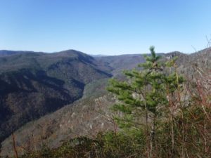
Don’t get me wrong. I love my trails as well. The Sycamore Trail at Umstead (especially during a rain, when its namesake creek is roiling). The trail network at Horton Grove Nature Preserve, which seems perpetually bathed in ethereal light. The 14-mile stretch of the Appalachian Trail north of Carvers Gap, which is one stunning 360-degree view after another.
But sometimes, the terrain beyond the confines of the well-maintained, blazed path beckons. The hollow where the distant sound of crashing water suggests a cataract. The distant rocky summit promising great views. The woods that call for no apparent reason other than you’ve never paid a visit.
The lure of the unknown.
Trails exist for good reason. To keep you from getting lost tops the list. They also help minimize our impact as visitors, keeping us from trampling sensitive ecosystems and basically letting the land, for the most part, be. Yet every once in a while … .
Yesterday, we shared a recent … wilderness wander at one of our favorite local haunts. We feel comfortable making an occasional trail departure, in large part because we follow a few simple rules that all but assure we will  make our way back to civilization. The best testament to these rules: we’re here to talk about them (rather than still in the woods, wandering, looking for the way out).
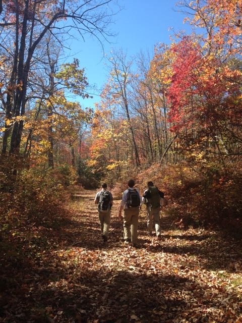
Before we share those simple rules: exploring off trail is something you should ease into. It’s best to head out your first few times with someone experienced, someone such as Rod Broadbelt, who this Saturday leads his annual Ruins Hike at Umstead State Park. Nearly all of this 10-mile hike, which visits 20 historic sites in the park, is off-trail. Rod’s done this hike for more than 20 years and knows the park well; hang with him (if you can) and learn his approach to off-trail exploring.
That hike meets at 8 a.m. Saturday morning in the Umstead lot at the end Harrison Avenue in Cary, off I-40 (exit 287). Questions? Contact Rod at rbroadbelt@nc.rr.com.
Now, some tips for off-trail exploring on your own.
- Before setting foot on the trail
* Take a map. This is mandatory every time you strap on a pack, even if you’re hiking a trail you know well. (What if there’s a blowdown or a landslide and you need to take evasive action?) A good topo map is preferred; a park-issued map, which often lacks topo lines and isn’t to scale is better than nothing.
* Take a compass. A map is of minimal help if you don’t know which way is up. Or north. Together, a map and compass are invaluable hiking companions.
 * Check sunset. Venturing off trail isn’t something you want to do if you’re running out of daylight. An especially important step this time of year.
 - On the trail
* Know your blazes. Likely, you’ll start out on an established trail. Familiarize yourself with the blaze for that trail and for adjoining trails. Odds are you’ll eventually want to return to the trail you departed from.
* Landmarks. When you reach the point where you plan to head off trail take careful note of what’s around you: an especially identifiable tree, a creek, a rock outcrop, whatever. Sighting a familiar object could be key for your return. - Leaving the trail
* Take a bearing on where you’re headed. Get out your map, get out your compass. Get your orientation (where’s north?) set. Pick an object in the distance, in the direction you want to explore. Take a compass reading, follow that compass reading.
* Confirm your bearing. Stop periodically, every 30 yards or so, to confirm your bearing. Are you still headed in the direction you set off in? If not, correct and continue.
* Landmarks. Again, keep an eye out for familiar landmarks that can help you navigate upon your return. - Objective reached! Now what?
It’s a big world out there, and you can’t see all of it from the trail. * Reverse course. Once you reach what it was you wanted to check out, return to the point where you left the trail by simply following your compass in the opposite direction. For instance, if you reached your objective by heading due north, return by heading due south.
* Shinny thing. Or maybe you see something else in the distance you want to investigate. Take specific note of where you are, get out your map, get your compass and set a new bearing to your new objective. Continue in the manner described above, stopping every 30 yards or so to make sure you remain on course.
* Reverse course (again). To return after reaching your second objective, simply head in the opposite compass direction you followed to your second objective until you get back to your first objective. From there, continue in the direction opposite you used when you left the trail.


Oops! Get off course?
A few tips for finding your way back to civilization:
- First, don’t panic. If you’re in a state park, for instance, you’re dealing with a limited amount of space. The largest state park in North Carolina (South Mountains) is just 18,400 acres; by comparison, Umstead in Raleigh is about 5,600 acres, Crowders Mountain east of Charlotte is 5,100 acres and Hanging Rock is less than 7,900 acres. You won’t be lost for long.

An old roadbed may lead to civilization (or be a trail). * Scout for an irregularity in the terrain. Most trails are distinguishable as a consistent disruption in the distance, appearing as a flowing, though sometimes barely discernible, line.
* Look for running water. Find a stream? Follow it downhill; that’s generally where you’re more likely to encounter civilization.
* Look for an old roadbed. Much of our public land — state parks, national forests, etc. — was once farmed or forested. Old roadbeds weave throughout much of this land. Some of these old roadbeds appear on maps. If you can find an old roadbed — typically marked by parallel dashed lines — it may give you a sense of how to regain the trail (it may actually be, or become at some point, a trail).
* Still flummoxed? If you feel you are hopelessly lost and perhaps in danger, call the land manager for where you are hiking: the map you have should have a contact number. I’ve heard more than one tale of confused paddlers lost amid the bald cypress and water tupelo on Merchants Millpond who called the park office and were guided in over the phone.
* Last resort. If you can’t raise anyone in the park office, as a last resort, call 911. They can get ahold of park/forest officials after hours and, best case, guide you in over the phone, worst case send a team out after you.
Basic navigation: GetHiking! Wayfinding 101
If you’re still trying to get comfortable following marked trail and want to become more confident in your backcountry navigation, our GetHiking! program is launching a monthly wayfinding skills clinic in January. “Stay the course — and what to do if you lose it,” will start with a half-hour session familiarizing you with how to read a map and use a compass. Then, we’ll head down the trail and talk about how to make sure you stick to it — and what to do if you don’t. We’ll also do a little off-trail exploring to further hone your navigation skills and build your confidence.
For more information and to sign up for this fee course, either email joe@getgoingnc.com or keep an eye on the GetHiking! Triangle Meetup page; details will be posted soon.
* * *
Like us on Facebook and get health, fitness and outdoors news throughout the day.