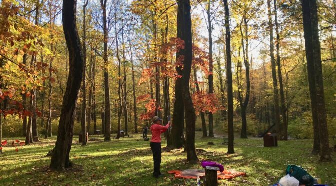
If you get the urge to check out fall color in the next couple of weekends, a bit of advice:
Don’t go where the leaf peeping experts say to go.
Their advice gravitates to the easily accessible go-to color hotspots, mostly along the easily accessed Blue Ridge Parkway: Graveyard Fields, Rough Ridge, Price Lake … . Sure, photos taken within the past few days scream chamber-of-commerce-certified color, but they’re screaming it to the tens of thousands of others looking for a quick autumn fix. A fix that can be had without venturing too far from the car. With a classic fall forecast for this weekend, expect those hotspots to be just that in more ways than one.
But fret not: there’s plenty of great color to be had, color you don’t necessarily need to share with the rest of the world.
Here are five of our favorite spots for seeking kaleidoscopic solitude. A quick note: These are not drive-by visits; you’ll need to invest some sweat equity — even in 50-degree temperatures — to find the color you seek. We’ll give you a sense of how much effort is required in each entry. We also share what the hike is an alternative to that’s popular nearby.
1. Big East Fork Trail
Pisgah National Forest
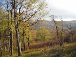
Location: 18082 US-276, Canton, NC 28716. GPS: 35.365956,-82.8198767
Type of hike: Out-and-back
Distance: About 7 miles
Difficulty: It’s not the elevation gain, but the rocky passage along the creek that makes for challenging — and sometimes slow — going. You’re not likely to cover the entire distance of the trail; it’s best to set a turnaround time and stick to it.
Alternative to: Graveyard Fields
I haven’t hiked this trail in the fall, but I have hiked it in the inverse season: early spring, when sprouting leaves reflect the color they’ll turn come fall. The color from my visit 20 years ago remains burned in my brain. So does the wild nature of this hike, which begins from a trailhead off U.S. 276 2.8 miles north of the Blue Ridge Parkway. The trail spends its time along, and in, the Big East Fork of the Pigeon River, on a comparatively (for the region) flat run that gains just 800 vertical feet. With multiple creek crossings, this can be a wet hike and one hard to follow: just remember the trail sticks to the water. In addition to the rich color from the dense hardwoods overhead, you’re treated to waterfalls along the way.
More info here.
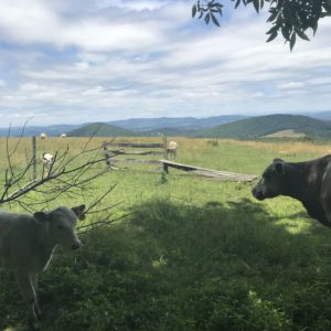
2. Mountains-to-Sea Trail at Holloway Mountain Road
Blue Ridge Parkway
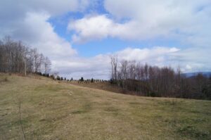
Location: From Milepost 298.6 of the Blue Ridge Parkway, head west on Holloway Mountain
Road for about a mile, to where the MST crosses. GPS: 36.13978, -81.75740
Type of hike: Out-and-back
Distance: 3.8 miles (7.6 miles roundtrip)
Difficulty: Moderately easy: trail is in good shape, the elevation gains moderate
Alternative to: Rough Ridge and Price Lake
Heading west on the MST from Holloway Mountain Road, the trail goes uphill into an open pasture, then spends a mile or so noodling through smaller pastures; the edge forests through here should be good for early color. Note: when you enter one of these clearings, the trail may not be obvious; if not, take a moment to survey across the way for the next visible white-dot MST blaze. These pasture pockets give way about midway to dense forest, where the evergreens should provide nice contrast to the emerging hardwood color. We suggest turning around just shy of the Boone Fork Parking Area, a popular access spot along the Parkway.
More info here, at the Mountains-to-Sea Trail online grail guide for this section.
3. Mountains-to-Sea Trail at Devil’s Garden Overlook
Blue Ridge Parkway
Location: Devil’s Garden Overlook, Milepost 235.7, Blue Ridge Parkway. GPS: 36.43404, -81.10429
Type of hike: Out-and-back
Distance: 3.6 miles (7.2 out-and-back)
Difficulty: Relatively easy: good trail surface and moderate elevation change
Alternative to: Doughton Park
This 3.6-mile stretch may get the award for least appreciate stretch of the MST in the high country. For starters, the turnaround point, at Brinegar Cabin, essentially marks the turnaround point for people hiking east from Doughton Park. The cabin is a carrot: they’ve walked 3 miles from the main parking area to see it — time to turnaround. Devil’s Garden Overlook itself should provide a good view of color cascading down the Blue Ridge Escarpment. From there, take the MST west, and in a mile-and-a-half, cross the Parkway to Air Bellows (as opposed to Doctor Bellows) Gap for great views of color cascading downhill to the west. Much of the rest of the hike involves intimate passage through quiet woods on the way to your turnaround at Brinegar Cabin (which is well worth the visit).
More info here, at the Mountains-to-Sea Trail online grail guide for this section.
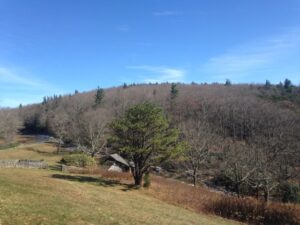
4. Big Lost Cove Cliffs
Wilson Creek area, Pisgah National Forest
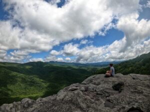
Location: Trailhead is along FR 464 about 4 miles west of NC 90, near the town of Mortimer. GPS: 36.0081995,-81.8706308
Type of hike: Out-and-back
Distance: 1.7 miles (3.4 miles out-and-back)
Difficulty: Relatively easy: there’s a good climb at the beginning of the hike, a steep but short climb on the hike back.
Alternative to: Wilson Creek gorge
Wilson Creek gets loved to death — the main gorge, at least. But venture into its side attractions and you’ll find hidden treasures galore, one of which is the 1.7-mile trail leading out to Big Lost Cove Cliffs. The beginning of the hike is less-than-inspiring, a climb, steep at times, to a ridge. But then, it’s a mellow ramble through tight woods until the trail dips into an open hardwood forest and then, shortly, deposits you at Big Lost Cove Cliffs. Come prepared to spend some time on this ample rock outcrop that offers great views of the valley below and, on a clear day, of Grandfather Mountain and the Blue Ridge beyond. Against a blue sky, it’s one of the best views around.
More info here.
5. Rock Castle Gorge
Rocky Knob Recreation Area, Blue Ridge Parkway (Virginia)
Location: Primitive camping trailhead at the base of the gorge, off VA 8. From the Blue Ridge Parkway near the Rocky Knob Campground, take VA 8 headed south. After 3.6 miles, go right on Rock Castle Road, which will terminate shortly at the trailhead. Hike in about 200 feet to pick up the trail.
Type of hike: Loop
Distance: 10.4 miles
Difficulty: Hard. There are climbs at the beginning, steep drops about two-thirds of the way in, some scrambling.
Alternative to: Trails along the Parkway
Wait, if this trail is along the Parkway, how is it an alternative to trails along the Parkway? Good point. And for maybe a mile and a half, where access is made easy along the Parkway, it’s not an alternative. But for the most part, this is one gorgeous hike that the masses aren’t likely to undertake. And they certainly aren’t going to pick it up from this hidden trailhead at the bottom of the gorge. Pick up the trail and hike counterclockwise, hiking up Little Rock Castle Creek through a spectacular hardwood forest. Mellow at first, the trail has a steep climb requiring some scrambling, before entering another mature hardwood forest and, shortly, reaching the Parkway. From there, it’s about 3.5 miles along the ridge, through several open meadows, before descending back into the gorge. The last 2.5 miles is a relaxing downhill along Rock Castle Creek.
More info here.
* * *
GetHiking! with Co-workers and Friends
Speaking of this incredible fall weather and the resulting color, wouldn’t it be great to have your own, personal hiking group — with friends or coworkers — that got together and hiked once a week? A hike that lasts an hour or so, is geared toward your group’s ability, that’s near where you live and that’s planned and led for you? That’s our GetHiking! with Co-workers and Friends hiking program! Learn more about the program and how you can get started with a group of up to 10 co-workers or friends, here.