It snowed Wednesday night, you had to work Thursday and today. Alas, the meager yet magnificent snowfall will be gone by the time you can hike it this weekend.
Or will it?
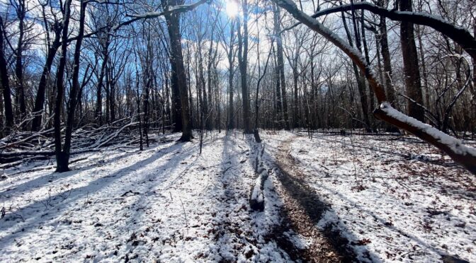
Cold temperatures Thursday and today mean there likely will be some snow left along the trail come Saturday — if you know where to look.
Where’s that? you ask.
On north-facing slopes.
As I discussed on today’s Morning Walk With Joe (Mondays, Wednesdays and Fridays, 8 a.m.-ish), just about anywhere you regularly hike in the rolling piedmont will have a north-facing slope significant enough to keep winter’s low-lying sun from completely melting our midweek dusting. One way to find out where those slopes are is at caltopo.com, where you can zero in on your area of interest, click on “Slope Angle Shading,” pick the degree of angle and find those north-facing slopes. Another way is to check out the list below.
Five hikes with shaded north-facing slopes
- Occoneechee Mountain State Natural Area, Hillsborough. Hike the 2.2-mile Mountain Loop Trail (your destination is slightly closer hiking counterclockwise), and as the trail snuggles up to the Eno River, a 30-foot north facing bluff keeps it cool enough to support a colony of plants more common to the Southern Appalachians, including mountain laurel, rhododendron and galax, which look all the better against snow. Details and directions here.
- Pilot Mountain State Park, Pinnacle (north of Winston-Salem). The 3.3-mile Pilot Creek Trail starts from an access north of the pinnacle (meaning fewer hikers) and wraps around the north flank of the 2,421-foot mountain. You should see remaining snow much of the way. Details and directions here.
- Cane Creek Natural Area, Snow Hill (south of Burlington). This new addition (spring 2020) offers a unique chance to explore the compact Cane Creek Mountain range, which tops out around 1,000 feet. From the Pine Hill Trailhead, take the 2.5-mile Northern Approach Trail counterclockwise; you’ll spend nearly 80 percent of the hike on the leeward (in a sunshine sense) side of the mountain. Details and directions here.
- Hanging Rock State Park, Danbury (north of Greensboro). On a sunny winter’s day (as Saturday is forecast to be), Hanging Rock will be one popular state park. But not if you start from the Flinchum Road Access on the Dan River and hike up the Indian Creek Trail, which stays in the shadow of the park for most of its length. Bonus: hike 3 miles up to Window Falls, enjoy a snowy waterfall, then head back down the mountain and avoid the crowds trickling down from the Visitor Center above. Details and directions here.
- Knight Brown Nature Preserve, Stokesdale (north of Greensboro). This 189-acre preserve courtesy the Piedmont Land Conservancy features a bowl served by three trails — Beechwood Bottom, Creekside, Leatherwood — that offer about three miles of hiking, much of it, especially along Belews Creek, protected from the sun. Details and directions here.
- And if you can’t make it Saturday? The forecast suggests there’s a chance of more snow coming Sunday.
GetOut! And enjoy.
* * *
Learn more
Morning Walk with Joe on Facebook Live. I talk more about strategies and places for finding lingering trailside snow this morning’s Morning Walk. Find it on our Facebook page.
For more detailed information and direction on exploring Cane Creek and the Knight Brown Nature Preserve, check out our guides for both areas: