
We’re all wondering the same thing: are my favorite places to explore open post Hurricane Florence?
Here’s a look at what I’ve found for our upcoming GetHiking! and GetBackpacking! adventures. Hopefully, my sleuthing can help you in figuring out your own upcoming adventure plans.
GetBackpacking! A Weekend on the Appalachian Trail between Carvers Gap and U.S. 19E
When: This weekend
What we learned: I wasn’t worried about the trail being flooded: it begins above 6,000 feet and stays high for much of its 13.7-mile run. Still, my first check was with the Appalachian Trail Conservancy website, whose Trail Updates page is a complete rundown of current closings, reroutings and other issues that may affect your hike. The North Carolina section (updates are broken down by state) listed no specific advisory for this stretch, though it did advise caution in general for downed trees and hanging limbs as a result of the storm. Of greater concern were the roads getting to the trailhead: Florence dropped some wet on the mountains, and landslides had been reported. But not on the roads we take, according to the N.C. Department of Transportation’s Travel Information page and its interactive map.
Status: It’s a go
GetHiking! Camping Weekend: Grayson Highlands and Mount Rogers
When: This weekend
What we learned: Virginia closed all of its State Parks in preparation for Florence, but all have now reopened, including Grayson Highlands. A look at the Grayson Highlands State Park page shows that only one park facility is closed, and it isn’t our group campsite. As for the Mount Rogers end of the trip, the USDA Forest Service site for both George Washington and Jefferson National Forests reported that all recreation areas were closed. That, though, from a post dated Sept. 12, before the storm. A call to the “customer service desk” for both forests indicated it might be faster to leave a message than to wait for a representative. It was also unclear whether the Virginia Creeper Trail, also part of the trip, was open.
Status: On hold, likely to postpone
GetHiking! Classic Escape to Curtis Creek and Graybeard Mountain
When: Weekend of Sept. 28-30
What we learned: Curtis Creek is in the Pisgah National Forest. (In fact, it was the first tract of land in the Pisgah, back in 1913). It’s in a particularly narrow valley that descends from the Black Mountains to the Piedmont, and thus seems especially vulnerable to flooding. And while it, along with the rest of the Pisgah, was closed prior to Florence, it has reopened. Graybeard Mountain is rather unique in that it is part of the Montreat Conference Center’s 2,500-acre Montreat Wilderness. It remains open to hiking as well, according to the website.
Status: It’s a go.
GetBackpacking! Intro to Backpacking Graduation Trip to South Mountains State Park
When: Weekend of Sept. 28-30
What we learned: One of the many reasons we love our North Carolina State Parks is that they do a great job of keeping us informed. All parks were closed last week; on Monday, the park website reported that some parks would reopen on Tuesday, and as Tuesday dawned, 24 parks had reopened, including South Mountains. A note atop the park’s page notes that debris cleanup may be occurring, so keep an eye out.
Status: It’s a go.
GetBackpacking! Overnight Sampler at Eno River State Park
When: Sept. 29-30
What we learned: The park is open. However, a bridge linking the Buckquarter Creek and Holden Mill trails is washed out, closing the Holden Mill Trail until the bridge can be fixed or replaced. We don’t necessarily cross the bridge, but it involves a creek that we will need to cross upstream. Probably worth scouting to make sure the rock-hop crossing we use is still in place.
Status: It’s a go
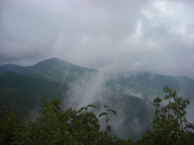
GetBackpacking! Intro to Linville Gorge
When: Oct. 5-7
What we learned: As far as we can tell from the Forest Service website, the gorge is open. However, we saw some video posted of Linville Falls running at 8,000 cubic feet per second: it’s typically flow is 100 to 200 cfs. Since the gorge is extremely steep and narrow, it’s a good bet the bottom of the gorge — and the campsites therein — have been hit. However, this trip base camps on the east rim, well above the fray. One of our favorite sources for the gorge — LinvilleGorge.Net — didn’t have information up just yet; we’re awaiting approval to become part of the Linville Gorge Facebook Group, which should have some up-to-date, hands-on information.
Status: It’s a go (though we may need to tweak the plan)
Beyond this two-week window, things look good, with one exception. The first weekend in December we have a backpack trip scheduled on the Neusiok Trail in the coastal Croatan National Forest. The forest is downstream from New Bern, which received 16.65 inches of rain from Florence. A saturated forest floor combined with hurricane-force winds and a largely pine forest (pines have shallow roots) means there could be a significant number of trees down. Since we doubt anyone’s been in yet to assess the damage, we’ll wait a week or two before checking on this one. Our source: the Carteret County Wildlife Club, which maintains the trail. Another good source: NeusiokTrail.org.
And if the Neusiok isn’t open by December? The 21-mile trail is one of our most popular backpack trips, but if it can’t happen, we’ve got a pretty exciting coastal alternative in mind just across the state line, False Cape State Park and the Back Bay National Wildlife Refuge in Virginia.
Funny, because while I’ve known about Back Bay, it never occurred to me as a good backpacking destination until I needed to start snooping around. Amazing how a potential roadblock can expand your horizons.
Happy trails!
Joe
Resources
The sources we used to check on our trips (which may be helpful for checking on yours):
- Appalachian Trail Conservancy
- N.C. Department of Transportation’s Travel Information
- Virginia State Parks
- Grayson Highlands State Park
- George Washington and Jefferson National Forests
- Montreat Conference Center / Wilderness
- South Mountains State Park
- Eno River State Park
- Nantahala National Forest
- Pisgah National Forest
- LinvilleGorge.net
- Croatan National Forest
- Carteret County Wildlife Club
- NeusiokTrail.org
- Back Bay National Wildlife Refuge
- False Cape State Park
For details on the trips mentioned above, visit GetHiking! Triangle.