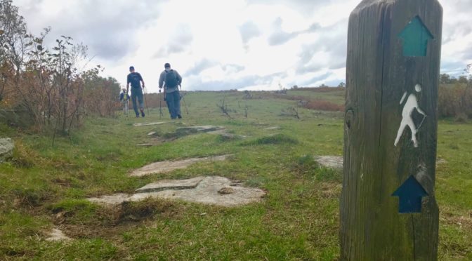
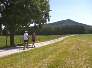
Something about cool, fall weather makes you want to hike farther. Now that that weather has finally arrived, we’ve got some of those longer trails we think you might like. Here are 11, including nine in the Piedmont and two along the Blue Ridge Escarpment. (We’ll talk long trails at the coast in coming weeks, once the weather turns from cool to cold.)
Piedmont
1. Umstead State Park: Company Mill Trail with Sycamore Loop
10 miles
Raleigh
A figure-eight double lollipop loop that exposes you to the best of Umstead. Starting from the Harrison Avenue entrance to Umstead (a k a the Reedy Creek entrance) on the Company Mill Trail, top three small ridges on your way to Crabtree Creek. Cross the green metal bridge and go right. You’ll follow Crabtree for a spell, climb to the bike and bridle trail that bisects the park and continue across. Shortly, you’ll hit a kiosk indicating a short spur to the Sycamore Trail; follow it to another B&B trail, go left over the bridge, then pick up Sycamore just past the bridge, to the right. There’s a half-mile stretch along Sycamore Creek (quite lively just after or during a rain), then the trail climbs through the hardwood Piedmont forest prevalent throughout before crossing another B&B. Within a quarter mile, the trail Ts. To get in your full 10 miles, go right to yet another B&B crossing, then turn and complete the opposite side of the Sycamore-Company Mill figure-eight. Lots of up-and-down, but nothing sustained. No water along the way (don’t risk filtering these urban creeks), so pack plenty.
Trailhead: 2100 N. Harrison Ave,, Cary.
More info, including a map, at the Umstead State Park website.
 2. Uwharrie National Forest: Birkhead Mountain Wilderness lollipop loop
11.8 miles
Asheboro
Starting from the trailhead off Tot Hill Road, you’ll hike the Birkhead Mountain Trail south for two miles before hitting the popular loop that Boy Scouts, among others, have been using for years to cut their backpacking teeth. Where the Robbins Branch Trail enters from the right, continue straight on the Birkhead for two miles. Note along the way that despite the fact this is a designated wilderness, the trail is well blazed. After two miles, go right on the Hannahs Creek Trail, where, for the first time, you abandon ridgelines in favor of passages along holly-clogged creeks. After a mile and a half, go right on the Robbins Branch Trail, which climbs a rocky (for the Piedmont) ridgeline before dropping to its namesake creek and rejoining the Birkhead after 3.2 miles. Go left for the two-mile return to your car. You can filter water from Hannahs Creek and Robbins Branch, though both run low in summer and during dry weather.
Trailhead: 3091 Tot Hill Farm Road, Asheboro.
More info here.
3. Uwharrie National Forest: Uwharrie National Recreation Trail
25.3 miles
Troy/Asheboro
The Uwharrie National Recreation Trail has long been the default long hike for Boy Scouts in the Piedmont. In part, that was because it was the only game in town — and what a game it was, extending 50 miles at one point in the 1970s. The trail shrank in the 1980s and 1990s, but has since rebounded and is back up to about 40 miles. This stretch remains the classic Uwharrie Trail. Starting from the trailhead off NC 24/27, the trail heads north through what was once a mighty mountain range, with peaks topping 20,000 feet. Today, nothing along the trail reaches 1,000 feet, and while the climbs aren’t Appalachian, they’re more sustained than any you’ll find elsewhere in the Piedmont. It’s a good workout, and great training for backpackers prepping for a mountain trip. Several small waterways cross paths with the trail and can be filtered — when they’re running.
Trailheads: The southern trailhead is 9.3 miles west of Troy on NC 24/27; the northern trailhead is at 6871 High Pine Church Road, Asheboro.
More info: For information on hiking the Uwharries, consult the “Uwharrie Lakes Region Trail Guide,” by Don Childrey, here; find a detailed trip description of the 22.9-mile hike from NC 24/27 to the Jumpingoff Rock Trailhead in “Backpacking North Carolina” (UNC Press, 2011).
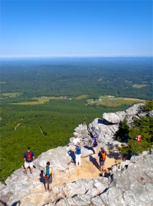
4. Hanging Rock State Park: Moore’s Knob and Indian Creek trails
5.5 / 11.5 miles
Danbury
Starting from the Visitor Center, the 4.3-mile Moore’s Knob Loop Trail makes a dandy warm-up. It starts innocently, passing the lake and bathouse, then probing a tunnel of holly. About a mile in, it’s time to get down to business, with a long ridge ascent to Moore’s Knob. It’s a bit relentless, this climb, getting rockier and ridgier the higher you get. The payoff: great 360 views from the observation tower atop Moore’s Knob. Continue the loop back to the Visitor Center for Round 2. The Indian Creek Trail descends, along with scores of hikers, to Hidden and Window falls. Return to the Visitor Center from here and it’s a 5.5-mile hike. Continue another three miles to the Dan River and back and you’re at 11.5.
Trailhead: Visitor Center, 1790 Hanging Rock Park Road, Danbury
More info here.
5. Crowders Mountain State Park/Kings Mountain State Park (S.C.): Ridgeline Trail
5.5, 9, 12 miles
Gastonia
The 6.2-mile Ridgeline Trail joins two state parks (Crowders Mountain and Kings Mountain) and the Kings Mountain National Military Park, plus it involves two states, which gives you added bragging rights. Starting from the Crowders Mountain Visitor Center, hike to the base of Kings Pinnacle and don’t pass the opportunity to take the short spur to the top for great views. Back on the Ridgeline Trail, continue south through rolling Piedmont countryside. Near the south end of Crowders Mountain State Park, you’ll see a sign for the Boulders Access area; turn around here for a 9-mile hike (for a 5.5-mile hike, turn around at NC 161). The Ridgeline Trail officially ends at South Carolina state line — but you can continue on into the Palmetto State, which is dead flat to Kings Mountain State Park. To avoid the crowds, start from the Boulders Access, 108 Van Dyke Road, Kings Mountain.
Trailhead: Sparrow Springs Access and Visitor Center, Crowders Mountain State Park, 522 Park Office Lane.
More info here.
 6. Eno River: Mountains-to-Sea Trail
7.8 miles
Durham and Orange counties
Starting from the west, at the Pleasant Green Access, hike under Pleasant Green Road bridge, up a bluff overlooking the Eno, around an abandoned quarry, through surprising stretches of steep climbs and sharp drops. You’ll part ways with the Eno, then you’ll reunite. At one point, pass the impressive foundation of a lodge that once stood atop a bluff over the Eno. This is perhaps the most challenging stretch of trail along the Eno. Pass under Cole Mill Road and the trail mellows, heading through flood plain forest and occasionally taking a more upland route. Your turnaround is the old pump station, which a century ago supplied water to Durham. Poke around the remains, a brick foundation, have lunch, then hike back the way you came.
Trailhead: 4770 Pleasant Green Road, Durham.
More info: Find detailed descriptions of the two sections making up this stretch on the Friends of the Mountains-to-Sea Trail website.
7. Mountains-to-Sea Trail at Falls Lake
21.8 miles
Wake and Durham counties
The Mountains-to-Sea Trail runs 60 miles along the south shore of Falls Lake through the Triangle. With the trail broken down into 18 day-hike sections, ranging in length from just under a mile to nearly seven, there are plenty of 20-mile(ish) permutations. Here’s a favorite. Starting from the Falls Lake ranger station off NC 50, hike west. Immediately, you are in the most remote stretch of the MST along Falls Lake, a nearly seven-mile run where signs of your fellow humans are rare (save for the remains of an old tobacco barn and what appears to have been a commercial chicken coop). The trail ducks in and out of coves on the lake, loses sight of it occasionally, has some boardwalked, swampy passages. At Little Lick Creek there’s an impressive pedestrian footbridge followed by an impressively narrow and long boardwalk. From there, it’s more hiking typical of a Piedmont hardwood forest. This 21.8-mile stretch concludes at the Hickory Hill Boat Ramp: no facilities but lots of parking. There is no water along the way; be sure to pack in plenty.
Trailhead: 14700 Creedmoor Road, Wake Forest
More info: For more information on navigating this stretch and for scouting your own 20-mile hike on the MST at Falls Lake, go here.
8. Sauratown Trail
Between Pilot Mountain and Hanging Rock state parks
21.6 miles
Though part of the statewide hiking-centric Mountains-to-Sea Trail, the Sauratown Trail originally was built for equestrians. As a result, it often exhibits a slightly more rugged feel. For instance, instead of a footbridge over every wet spot, you have running creeks that are rock-hopped. Also, horses apparently have less of a problem with direct assaults on climbs, adding a vigorous ascent or two. All of which underscores the particular allure of this trail: its naturalness. The trail is never hard to find, but you’ll know you’re not on a finely groomed state park trail. Starting from Pilot Mountain, the trail heads east, tracing the north flank of Sauratown Mountain. There are some particularly scenic passages, including a waterfall or two that would seem more appropriate about 75 miles to the west, along the Blue Ridge escarpment. There’s a doozy of a climb when the trail reaches Hanging Rock State Park, but you’re rewarded with great views from atop Moore’s Knob. End your hike at the Hanging Rock Visitor Center. Note: Much of this trail is on private land, access generously granted from local landowners. Occasionally, land changes hands and the new land owner may not be as keen about a public trail. Thus, trail rerouting is common, and is well documented on the Sauratown Trails Association website.
Trailheads: Pilot Mountain State Park Visitor Center, 1792 Pilot Knob Park Road, Pinnacle, to the west, Hanging Rock Visitor Center, 1790 Hanging Rock Park Road, Danbury, to the east.
More info: Check out the aforementioned Sauartown Trails Association web site.
9. Pilot Creek Trail
Pilot Mountain State Park
6.6 miles (out and back).
When this list first appeared we recommended the trails accessed at the summit of Pilot Mountain. But since 2012, those trails have been discovered: on nice weekends it can take a half hour or more just to score a parking spot up top. Now, our favorite Pilot Mountain trail is Pilot Creek, which starts from an access off Boyd Nelson Road north of the park and works its way along the north flank of the mountain to connect with the Grindstone Trail. Pilot Creek offers much of what hikers flock to Pilot Mountain for: rocky terrain and some moderately challenging climbs. You won’t get the views (it sticks to the base of the mountain), but you won’t get the crowds, either.
Trailhead: Pilot Creek Access, Pilot Mountain State Park, 382 Boyd Nelson Road, Pinnacle
More info here.
Blue Ridge Escarpment
10. Mountains-to-Sea Trail at Holloway Mountain Road
Blue Ridge Parkway
7.6 miles
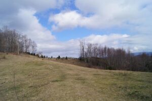
Heading west on the MST from Holloway Mountain Road, the trail goes uphill into an open pasture, then spends a mile or so noodling through smaller pastures; the edge forests through here should be good for early color. Note: when you enter one of these clearings, the trail may not be obvious; if not, take a moment to survey across the way for the next visible white-dot MST blaze. These pasture pockets give way about midway to dense forest, where the evergreens should provide nice contrast to the emerging hardwood color. We suggest turning around just shy of the Boone Fork Parking Area, a popular access spot along the Parkway.
Trailhead: From Milepost 298.6 of the Blue Ridge Parkway, head west on Holloway Mountain
Road for about a mile, to where the MST crosses.
More info here, at the Mountains-to-Sea Trail online trail guide for this section.
11. Rock Castle Gorge
 Rocky Knob Recreation Area, Blue Ridge Parkway (Virginia)
10.4 miles
This is one gorgeous hike that the masses aren’t likely to undertake. And they certainly aren’t going to pick it up from this hidden trailhead at the bottom of the gorge. Pick up the trail and hike counterclockwise, hiking up Little Rock Castle Creek through a spectacular hardwood forest. Mellow at first, the trail has a steep climb requiring some scrambling, before entering another mature hardwood forest and, shortly, reaching the Parkway. From there, it’s about 3.5 miles along the ridge, through several open meadows, before descending back into the gorge. The last 2.5 miles is a relaxing downhill along Rock Castle Creek.
Trailhead: Primitive camping trailhead at the base of the gorge, off VA 8. From the Blue Ridge Parkway near the Rocky Knob Campground, take VA 8 headed south. After 3.6 miles, go right on Rock Castle Road, which will terminate shortly at the trailhead. Hike in about 200 feet to pick up the trail.
More info here.
* * *
Cool off-trail hikes
Another thing we like to do when the weather cools: hike off trail. On old roadbeds, on game trail, through areas choked with vegetation in warmer months. We do 5 such hikes in this series of monthly hikes, which begin in November and end in March. Learn more here.