Category Archives: Weather

Warm up to cold weather hiking with these strategies

If you’ve been hiking in the last couple days, you’ve likely walked out the front door on hike morning and had your first Aha! moment of the season. 

Aha! as in, “Aha, I need to grab another layer or two!”

As Aha! moments go, it’s one of our favorites. We love hiking late-fall-into-winter: the air is typically dry, the diminished foliage lets you see deeper into the woods, the increasingly angled winter sunlight seems to lite the forest from the ground up. read more

Layer up and Get OuT

On Saturday morning’s GetHiking! hike at Umstead State Park, half the number of hikers who signed up showed up. No mystery there: it was cold.  

What is a mystery is why so many hikers let a little thing like freezing temperatures keep them off the trail. As we may have mentioned (just last week, in fact), we love a winter hike: among other things, there are fewer people, fewer bugs, and it’s blissfully quiet. Yet too many people miss out because they don’t know how to dress. Let’s solve that problem here and now. read more

To hike, or not to hike

To hike, or not to hike. That was the question Monday upon waking to see that not only were Sunday’s 11 inches of snow still on the ground, but Mother Nature was adding another two. The second hike in our Tuesday Night Hikes series was scheduled for the next evening, on a stretch of the Mountains-to-Sea Trail along Falls Lake; looking out the window, I wondered if we could pull if off.

Thus began the evaluation process we go through when deciding whether the weather will affect a planned hike. It’s a process that goes something like this:

=&0=& I started following the forecast for Tuesday night a week ago. There was a suggestion of weekend snow at the time, though, as is often the case with snow, the amounts were vague, as were the locations to be affected. Usually for a day hike, I don’t start checking the forecast until two or three days out; for overnight trips, I begin checking about a week in advance to get a general idea of what might be coming. Three days out I will take a second, more serious look. If it appears weather could be an issue, I’ll …
=&1=&=&2=&The Tuesday Night Hike roster is a mix of experienced and less-so hikers. A decision about whether to hike in this case is complicated by the fact that the hike is at night, and not all the hikers — even the experienced ones — are as comfortable hiking under the lights. In general, if it’s an entry level trip I’ll judge the weather with a more critical eye for two reasons: 1) these are beginners, just starting out and might not have the gear to deal with rain, with cold or less- than-ideal conditions; 2) We want beginners to have a good first experience. You do an overnight trip with daytime temperatures around 70, overnight lows around 50 and clear skies, and who isn’t going to want to come back? On the other hand, if it’s an experienced group, we’re more likely to proceed if the weather isn’t optimal. About the only two things that will scuttle a trip for experienced folks is extreme cold (15 F or less) and a high likelihood of electrical storms.
=&1=&=&4=& Three days, because if the weather looks convincingly grim, this is when you need to begin alerting people that the hike may not happen, less so for a shorter day hike, but certainly for an overnight trip that people have to make plans in advance for, like canceling a pet sitter. I usually don’t make a final call this far out, but will let people know that the trip is in jeopardy and when we will let them know if it’s still on. In the  case of our Tuesday Night Hike, on Saturday, milk, bread and eggs were flying off the shelf as the forecasters were growing more certain of snow, and lots of it.
=&1=&=&6=& On Monday, it was less the forecast for Tuesday night and more the reality of the day. I wasn’t sure how much snow had fallen at the trailhead, but it was likely between 8 and 13 inches. The forecast called for some warming Monday and afternoon and Tuesday, but refreezing overnight: this snow wasn’t going anywhere soon. And what did melt was likely to turn to ice once the sun set. Usually, we’ll wait until the day before, at the earliest, to call a hike. Much can change in a forecast, which is why we sometimes will wait up until three hours before a hike to make a final call (in such cases, that’s often because we’re waiting to see what the weather radar, the final arbiter, indicates). A day out is when we start to consider our four cancellation factors: 

=&1=&=&8=&: =&9=&. We usually don’t cancel a hike because of extreme cold, but we will let people who have signed up know what kind of gear they will need to survive — yes, survive — a very cold hike.
=&1=&=&11=&. I personally love hiking in the rain, even a sustained rain. But then, I’ve got the gear for it. A forecast that looks reliably wet warrants an email to those who’ve signed up as to the rain gear they will need if they don’t want to wind up damp and dour.
=&1=&=&13=&. This is a big one. If just getting to the trailhead could be treacherous, we’ll cancel a hike.
=&1=&=&15=&

Post Hurricane Florence: What’s open, what’s not?

A moody Graybeard Mountain.

We’re all wondering the same thing: are my favorite places to explore open post Hurricane Florence?

Here’s a look at what I’ve found for our upcoming GetHiking! and GetBackpacking! adventures. Hopefully, my sleuthing can help you in figuring out your own upcoming adventure plans.

=&0=&

When: This weekend

What we learned: I wasn’t worried about the trail being flooded: it begins above 6,000 feet and stays high for much of its 13.7-mile run. Still, my first check was with the Appalachian Trail Conservancy website, whose Trail Updates page is a complete rundown of current closings, reroutings and other issues that may affect your hike. The North Carolina section (updates are broken down by state) listed no specific advisory for this stretch, though it did advise caution in general for downed trees and hanging limbs as a result of the storm. Of greater concern were the roads getting to the trailhead: Florence dropped some wet on the mountains, and landslides had been reported. But not on the roads we take, according to the N.C. Department of Transportation’s Travel Information page and its interactive map.

Status: It’s a go

=&1=&

When: This weekend

What we learned: Virginia closed all of its State Parks in preparation for Florence, but all have now reopened, including Grayson Highlands. A look at the Grayson Highlands State Park page shows that only one park facility is closed, and it isn’t our group campsite. As for the Mount Rogers end of the trip, the USDA Forest Service site for both George Washington and Jefferson National Forests reported that all recreation areas were closed. That, though, from a post dated Sept. 12, before the storm. A call to the “customer service desk” for both forests indicated it might be faster to leave a message than to wait for a representative. It was also unclear whether the Virginia Creeper Trail, also part of the trip, was open.

Status: On hold, likely to postpone

=&2=&

When: Weekend of Sept. 28-30

What we learned: Curtis Creek is in the Pisgah National Forest. (In fact, it was the first tract of land in the Pisgah, back in 1913). It’s in a particularly narrow valley that descends from the Black Mountains to the Piedmont, and thus seems especially vulnerable to flooding. And while it, along with the rest of the Pisgah, was closed prior to Florence, it has reopened. Graybeard Mountain is rather unique in that it is part of the Montreat Conference Center’s 2,500-acre Montreat Wilderness. It remains open to hiking as well, according to the website.

Status: It’s a go.

=&3=&

Making sense of a weather forecast

As part of my Monday morning ritual, I check the weather forecast for the hikes, trips and classes we have in the week ahead. It may be the most frustrating thing I do all week. What I have discovered, though, is there’s a whole lot more to deciding whether to proceed or pull the plug than simply checking the chance of bad weather.

Here’s a look at the process I’ve developed, using as an example a backpacking trip coming up this weekend.

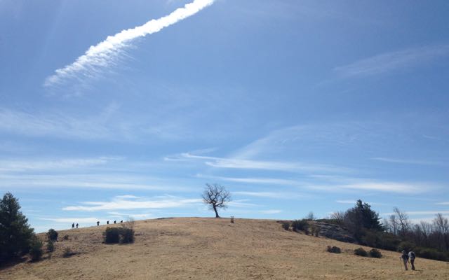
=&0=& =&1=&. This weekend, we have a GetBackpacking! trip to Linville Gorge. It’s an Intermediate Skills class, focusing on water crossings and navigating a designated Wilderness Area, where trails are rarely marked or maintained. 

=&2=&. These backpackers have previous backpacking experience and decent gear. Their previous experience means they’ve probably been through less-than-perfect weather and are equipped — both mentally and gear-wise — to deal with the elements. 

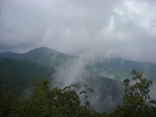
=&3=&. Certain areas — Linville, Grandfather Mountain and Mount Rogers in Virginia, in particular — are notorious for generating their own weather. So while you may have a fairly benign forecast for a region, keep in mind that it might not apply if you’re headed into a meteorological anomaly. 

=&4=&. When I’m checking several forecasts simultaneously on my Monday survey, I stick with one source. My go-to is the ten-day forecast on  WeatherUnderground.com. If the event is four or more days out, I just try to get a general feel for what the weather is looking like. This time of year, I look to see if a pattern of rain and thunderstorms is developing. Rain isn’t necessarily a deal-breaker; electrical storms are. On Monday, my Linville Gorge check for Friday, Saturday and Sunday were dominated by a gray cloud, a thick lightening bolt and daggers of rain — 70 percent chance each day, in fact. Time to panic? Not just yet.

=&5=&. If I see something worrisome, I’ll switch from my overall source to a source more focused on our destination. For the central and northern mountains of North Carolina, I rely on Ray’s Weather out of Boone. Ray’s was begun in the 1990s by Dr. Ray Russell, a computer science professor at Appalachian State, as a hobby. It’s evolved into a source that marries modern forecasting models with local knowledge of mountain weather. Ray’s forecast for Linville rang true with typical summer weather patterns: partly cloudy with widely scattered afternoon and evening thunderstorms. This suggests that we should hike early in the day and have camp set up by mid-afternoon. (For mountain trips, I’ll bore up as well, using a source such as mountain-forecast.com. But, for this Linville trip, it won’t be helpful). 

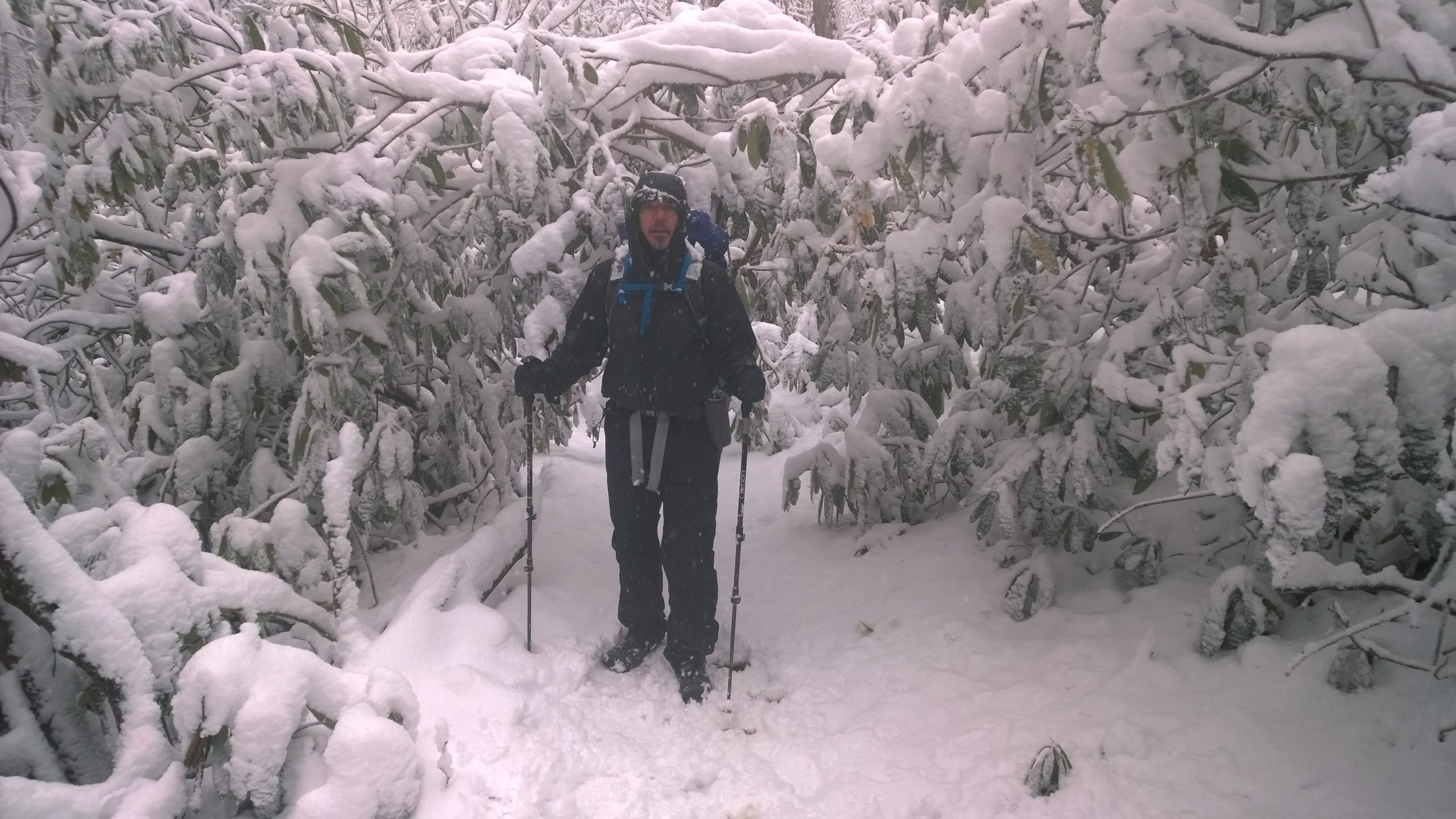
=&6=&. The reason I don’t start checking the forecast until five days out at the earliest stems from a four-day winter trip on the Appalachian Trail three years ago. On that trip, I started checking 10 days out, at which point 4 to 6 inches of snow was forecast, as were overnight lows in the upper teens. The next day, the snow forecast total had jumped to 12 inches and the overnight lows had dropped into the mid-teens. Over the next three days the forecast called for as much as 18 inches and the overnight low dropping to 7. Twice I was a mouse-click away from canceling the trip. Then, two days before the trip, the forecast backed off to about three inches. We did the trip and awoke the last morning to just an inch of snow, which made for a gorgeous hike out.

=&7=&. One of the last things I do, usually two to three hours before an event, is check the radar. I check for splotches of green, yellow, orange and especially purple, and I click the one-hour replay to see if the splotches are advancing toward our hike. One caveat: in summer, heat convection can cause stormy cells to pop up out of nowhere; just because weather wasn’t headed your way an hour ago doesn’t mean it isn’t now. Those wicked afternoon storms may cause me to cancel an after-work hike, but often it won’t bring an end to a weekend backpacking trip. 

=&8=&You may think that there’s nothing worse than canceling an outing because the weather looked bad, and then it’s just lovely out. What’s worse, though, is rolling the dice, saying what the heck, forging ahead — and running headlong into trouble. 

All it takes is one bad guess to convince you. Play it safe.

Happy trails,

Joe

Weekend weather read more