In December, a fire burned 1,050 acres at Pilot Mountain State Park. The Grindstone Fire was caused by a campfire run amok. While it caused no damage to structures, it singed a good deal of the 3,700-acre park north of Winston-Salem. And while the “damage” to the natural world may have looked significant, that’s not necessarily the case. Periodic wildfires are important to the health of any forest, which is the topic of Growth After Fire, an hour-long program at Pilot Mountain State Park Saturday at 2 p.m. “Join a park ranger to discuss fire’s effects on plant and tree growth after a fire,” according to the N.C. State Parks website. Learn more here. (Can’t make Saturday’s session? It will be repeated Sunday at 2 p.m.)
Tag Archives: Pilot Mountain State Park
Winter: Dread it, enjoy it
Winter is a season disliked more in anticipation than in reality.
That dislike begins the first day of summer. Though we generally do spend the summer solstice reveling in the most daylight of the year — 14 hours, 35 minutes and 8 seconds — in the back of our minds we know that it’s all downhill from here. The day after the solstice we’ll be down to 14 hours, 35 minutes and 6 seconds, two seconds that we won’t actually notice, but two seconds that we’re shorted all the same.

Fall evicts Summer this weekend; here’s where to hike
In case you haven’t seen the forecast for this weekend, fall finally arrives. After summer’s last stand (hopefully), we’re looking at daytime temperatures in the 70s in the Piedmont, in the 60s in the mountains, ideal for finally getting out and enjoying some fall hiking.
Head for the mountains in our midst
When you have a hankering to head for the hills, but don’t have time for a trip to the mountains, you can drive an hour or so to the mountains in the midst of the Piedmont.
In fact, long ago — 300 million to 500 million years — the Piedmont was the mountains. They bubbled out of the ground via volcanic activity, thrust as high as 20,000 feet by the crunching and colliding and folding of tectonic plates.
Alas, the effects of aging have a way of reducing one’s stature; like Great Grandpa Irving, their once towering presence has diminished. But they haven’t disappeared altogether.
Throughout the Piedmont, you’ll find relict mounds of Piedmont monadnocks, erosion-resistant rock that’s not going down without a fight. Some—Medoc Mountain in North Carolina, Smith Mountain and White Oak Mountain in Virginia—are recognized as outdoor playgrounds: Medoc Mountain and Smith Mountain as state parks, White Oak Mountain as a Wildlife Management area. Both offer hiking. Others — such as Thoroughfare Mountain, Mount Pony and Piney Mountain, all in Virginia — are in private hands. These are isolated remains, their neighbors long since worn to rolling hills.
But there remain several mountain ranges in the Piedmont where recreation is alive and well.
Uwharrie Mountains
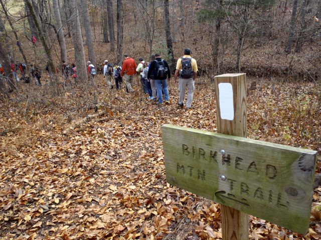
Probably the best-known mountains outside The Mountains are the Uwharries, which occupy a good portion of Randolph, Montgomery, Stanly and Davidson counties southwest of Asheboro, in the center of the Piedmont. The range tops out at just under 1,200 feet (1,188-foot High Rock Mountain in southwestern Davidson County), but there’s considerable relief in these hills, which are surrounded by rolling farmland a little over 300 feet above sea level. In the 50,000-acre Uwharrie National Forest, there are more than 215 miles of trail, according to Don Childrey in his “Uwharrie Lakes Region Trail Guide.” The backbone of hiking in the Uwharries is the roughly 40-mile (and growing) Uwharrie Trail, which runs from Troy on the south to near NC 49 on the north, and even includes a wilderness area. If you’re looking for long training hikes in preparation for hitting the Appalachians or heading out West, it’s hard to beat these trails, which are within an hour and a half of Charlotte, the Triad and the Triangle.
Sauratown Mountains
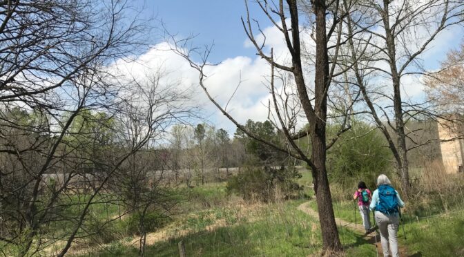
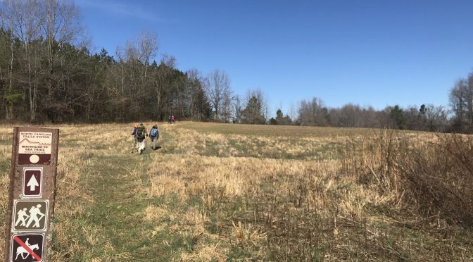
Also=&2=&popular from a hiker’s standpoint are the Sauratown Mountains, a range north of the Triad that’s defined by Hanging Rock State Park to the east and Pilot Mountain State Park to the west (in between is Sauratown Mountain, which has no public lands). Pilot Mountain with 25 miles of trail and Hanging Rock with more than 20 miles of trail offer the highest hiking in the Piedmont, reaching nearly 2,500 feet in elevation. And both offer the kinds of mountain-top views you long for in a summit, and waterfalls to boot. And the nearly 25-mile-long Sauratown Trail links the two.
Crowders Mountain
We’re hard-pressed to find a name for the mountain range that runs from Crowders Mountain State Park outside Gastonia to Kings Mountain State Park in South Carolina, but what’s in a name, anyway? Crowders Mountain, at 1,635 feet, and its neighbor, The Pinnacle, at 1,705 feet, offer an alpine experience for Charlotte hikers (and Charlotte mountain climbers as well). Crowders Mountain has 20 miles of trail, including the 6.2-mile Ridgeline Trail, which hooks up with an additional 40 miles of trail across the state line in South Carolina’s Kings Mountain State Park and Kings Mountain National Military Park.
Cane Creek Mountains
This lesser-known range in portions of Alamance, Guilford, Randolph, and Chatham counties was lesser known because it was short on public access to recreation. That’s about to change. In 2014, the Piedmont Land Conservancy acquired a 101-acre tract in southern Alamance County. PLC subsequently turned the land over to Alamance County Parks & Rec., which is developing trails on the property, part of the Cane Creek range. We’ll be back with more information about the preserve and it’s anticipated opening.
We’ve got several trips planned to the Piedmont mountains over the next two months. Join us and explore these mountains in our midst.
Happy trails,
Joe
Explore with us!
Our GetHiking! program frequently explores the Piedmont’s mountains. Coming up:
- Friday Crowders Mountain Extreme Hike, GetHiking! Charlotte. Details here.
- March 24 GetHiking! Classic Hikes: Pilot Mountain. Details here.
- April 14 Piedmont Explorer: Hanging Rock State Park. Details here.
Resources
For more information on the mountains mentioned today:
=&9=&“Uwharrie Lakes Region Trail Guide,” by Don Childrey (2014, Earthbound Sports. More info at donchildrey.com.
=&10=& For hiking in Pilot Mountain State Park, go here, for Hanging Rock State Park, go here. For information on hiking the Sauratown Trail, which is part of the Mountains-to-Sea Trail, go to this trail guide from the Friends of the MST.
=&3=& Check the
Crowders Mountain State Park website
Hike with us and avoid the spring crowds
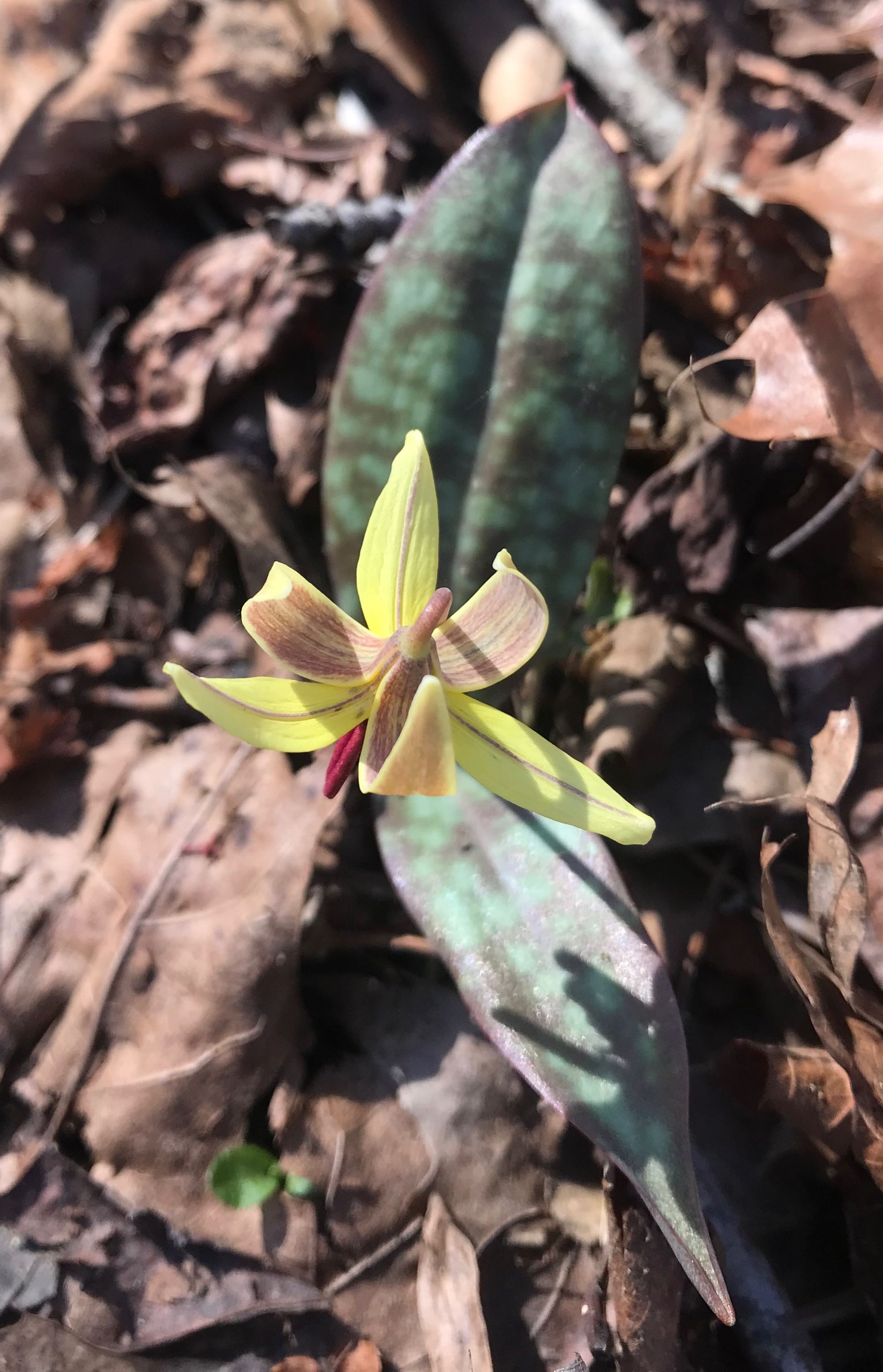
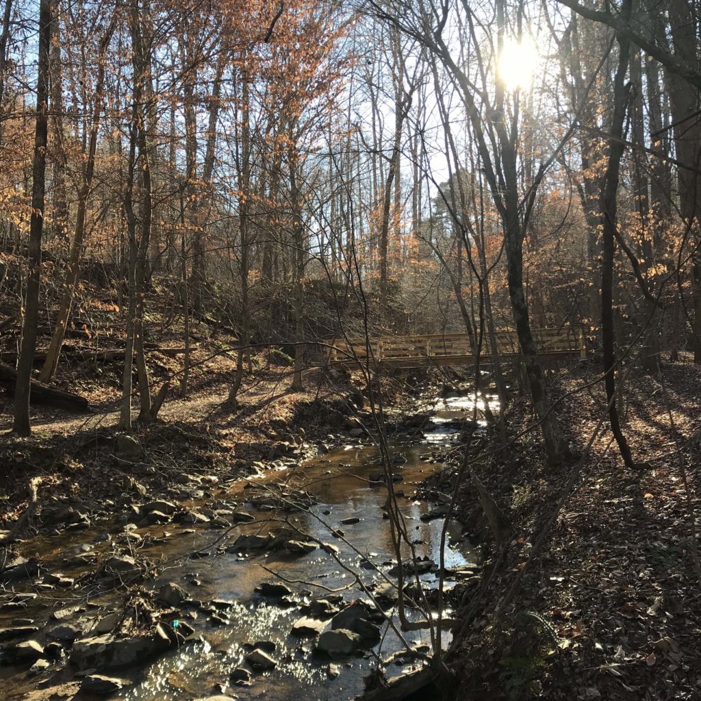
It started two weeks ago with a serenade by spring peepers in a pond at Horton Grove Nature Preserve. It was reinforced a day later by the sudden appearance of perky yellow daffodils near an old homestead along the Eno River. Then, last Friday, on a hike through bottomland forest at Ayr Mount in Hillsborough, I got the sign I’d been waiting for: a trout lily unfurling its delicate yellow and maroon petals.
The first wildflower of spring.
For some, the first sign of spring is when pitchers and catchers report to Florida. For others, it’s the closeout deals on winter wear at the mall. For me, it’s that first trout lily making its way through the leaf litter of the forest floor.
Come these first signs of spring, folks arise from their winter slumber, eager to take on the trails they abandoned in November. Temperatures climb into the 60s and 70s, and the trout lilies are followed by fields of spring beauties and bluets. The oaks, tulip poplars and hickories fill the canopy with pastel pinks and yellows and reds.
Everyone, it seems, wants to hike, and that’s great.
But it also presents a challenge, starting with finding a place to park at the more popular trailheads.
Come the first sunny, warm weekend of March, the two main parking lots at Umstead State Park in Raleigh — off Glenwood Avenue and Harrison Avenue — fill early; late arrivals park willy nilly where they can. Pilot Mountain State Park’s website includes an advisory that it can take up to 30 minutes to find a parking space. Crowders Mountain State Park has shuttle bus service from Gastonia.
That’s not to say you can’t find solitude, even on the most gorgeous of spring days.
At Umstead, for instance, the bike & bridle trailhead on the Glenwood Avenue side almost always has space, with access to Umstead’s best hiking, in the center of the park. The Pinnacle Hotel Access at Pilot Mountain usually has spaces, from which you can catch the Mountain Trail and climb to the summit via the Grindstone, Ledge Spring and Jomeoke trails. At Crowders Mountain, the remote Boulders Access feeds the Ridgeline Trail, from which you can take on a long romp into South Carolina.
Or, follow in the footsteps of our GetHiking! hike leaders, who take into account the potential spring surge. We aim to start from these and other lesser-known trailheads, to get you out on the trails sooner and with less angst.
In addition to the weekly hikes offered through our seven GetHiking! chapters, we have two special programs designed to avoid spring’s crowds while enjoying its offerings:
- The GetHiking! Triangle Spring Series begins March 11. We’ll hike every Sunday afternoon for eight weeks at a different location. For each hike, we offer a short (2-4 miles) and long (5-7 miles) version. The hikes in this series are designed to explore areas where spring wildflowers typically are blooming.
- In the GetHiking! Piedmont Explorer series, on the second Saturday of each month, we hike an area that may not be on your radar (but should be!). The hikes are 5 to 8 miles, start at noon, and last about three hours.
Join us as we hike the trails less traveled.
GetHiking! this spring
To find the GetHiking! hike nearest you, click on your local chapter.
=&2=&
GetHiking! Charlotte